
Ever since my first childhood visit to a railway museum, I have been interested in the railways of the UK. The romantic mystique of steam trains crossing the country, stopping off at quaint villages and seaside towns, was particularly appealing. Passing into adulthood, I still have that interest of the railways, but it has shifted to a more historical basis. The 20th century saw a massive cull of railways deemed difficult or expensive to maintain, especially in lesser served areas. Many of these lines no longer see any trains stopping at their platforms. Instead, their remains lay abandoned and forgotten, or buried under modern infrastructure.
In this series, I explore what remains of the abandoned railways of the UK by foot. I investigate their histories and their ultimate fates, and I assess whether these lines should be reopened one day.
The Tooting, Merton and Wimbledon railway ran one giant loop between Tooting and Wimbledon, with one half still used today. This post sees me explore the disused Merton branch of the line between Merton Park and Tooting Junction. Though a shorter line than previous posts in this series, there was nonetheless plenty to see.
A Brief History of the Line
Formation
The Tooting, Merton and Wimbledon railway opened on the 1st of October 1868. This was originally formed as an independent company by Act of Parliament in 1864, but was dissolved the following year. The running the line thus fell to two established railway companies. The first, the London, Brighton and South Coast Railway (LBSCR), ran services out of London Victoria and London Bridge down to Surrey, Sussex and the south coast of England. The second, the London and South Western Railway (LSWR), ran services out of London Waterloo towards Hampshire, Berkshire and Dorset. Today, these routes are run by Southern and South Western Railway, respectively.
The line comprised of two branches that effectively formed a loop between Tooting and Wimbledon. The first, the Wimbledon branch, would take passengers from Streatham to Wimbledon, through Tooting Junction and Haydens Lane (later Haydons Road). This route is travelled on today by Thameslink trains running the Sutton loop. The second, the Merton branch, departed Tooting Junction and travelled through Merton Abbey and Lower Merton (later Merton Park) en route to Wimbledon. The majority of trains reversed their section of the loop, however some did complete the whole circuit. Travelling through populated areas, both routes were initially well used, especially in peak hours. However, the introduction of the motor buses and the trams (something still prominent in this area of London) saw passenger numbers drop.
Decline and Closure
After World War I led to a pause in all services until 1923, the Wimbledon branch was electrified. The Merton branch did not receive this treatment which, ultimately, saved money on a wasted cause. In 1926 the London Underground’s northern line opened its extension to Morden, providing commuters with a fast and direct route into central London. This devastated passenger numbers on the indirect Merton loop. Just three years after the northern line reached Morden, in 1929, the Merton loop closed to passengers. The line remained busy with freight traffic, as Merton was seeing an uplift in industry at this time. However, this did not prevent the junction at Tooting being severed for the branch, meaning freight trains would need to go via Wimbledon if heading north.

Freight traffic would continue on the line for several decades after being closed to passengers, before it too ceased. On the 1st of May 1975, shortly after the last freight train ran to Merton Abbey, the line was closed and the track was subsequently lifted. To relieve congestion in central Merton, a new dual carriageway, Merantun Way (the A24) was laid across a section of the route around the old Merton Abbey station. The section between Wimbledon and the old Merton Park station still exists as part of the Croydon Tramlink.
Exploring the Line
Part 1 – The Modern Railway (Wimbledon – Merton Park)
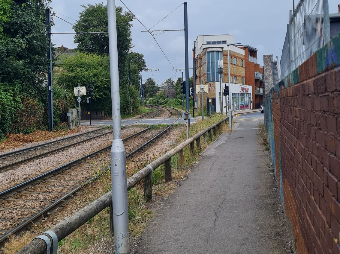
Following a doctor’s appointment in the vicinity, I grabbed a coffee from a well-known high street brand and headed to Wimbledon station. When the line was running, it would have occupied the platforms now used by Thameslink services on the Sutton loop, and the Croydon Tramlink. The trams are a great way to see the first section of the Merton loop, as they use the route of the old line as far as Merton Park. As it was a fairly nice day, with the sun occasionally peaking through the thin wispy clouds, I decided to walk south of the station, down Hartfield Crescent, to Dundonald Road tram stop. Though no trains stopped here, this was the site of an old level crossing, now replaced with traffic lights and a pedestrian crossing. A tram zipped by towards Croydon with almost ghostly silence as I waited for it to pass.
Walking down an alleyway on the other side of the crossing took me parallel with the old line, as another tram glided past en route to Wimbledon. I have only travelled on the trams a couple of times, but these seem like an efficient and quick way to traverse south London. Local residents, what are your thoughts on the trams?
This section saw the Merton loop share tracks with the Wimbledon and Croydon railway, which only closed in 1997. That the old line has been reused as far as West Croydon shows the effectiveness of the route for passengers. As I mused on this, I was on approach to the first intermediate station on the loop, Merton Park.
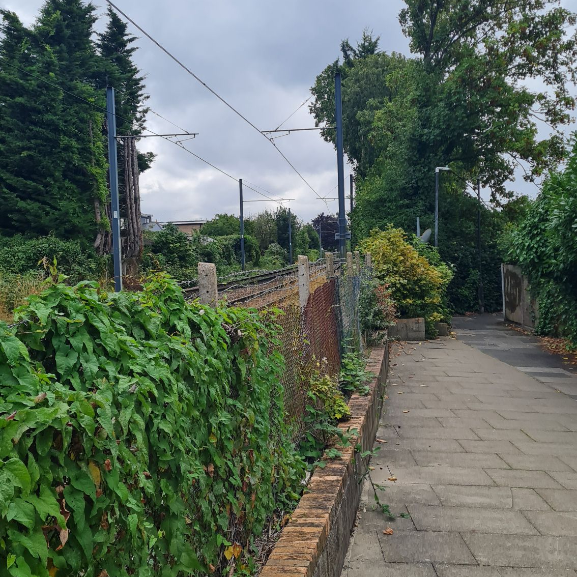
Merton Park
Year Opened: 1868
Year Closed: 1997 (1929 for the Tooting line)
History of the Station

Opened as Lower Merton station in 1868 as part of the Tooting, Merton and Wimbledon railway, it was a junction with the already established line to West Croydon. It was renamed to Merton Park station in 1887, which is also the name of the tram stop that now sits on its site. Old pictures show that there were three platforms, two curved platforms for the branch to Tooting, and one straight platform for the branch to West Croydon.
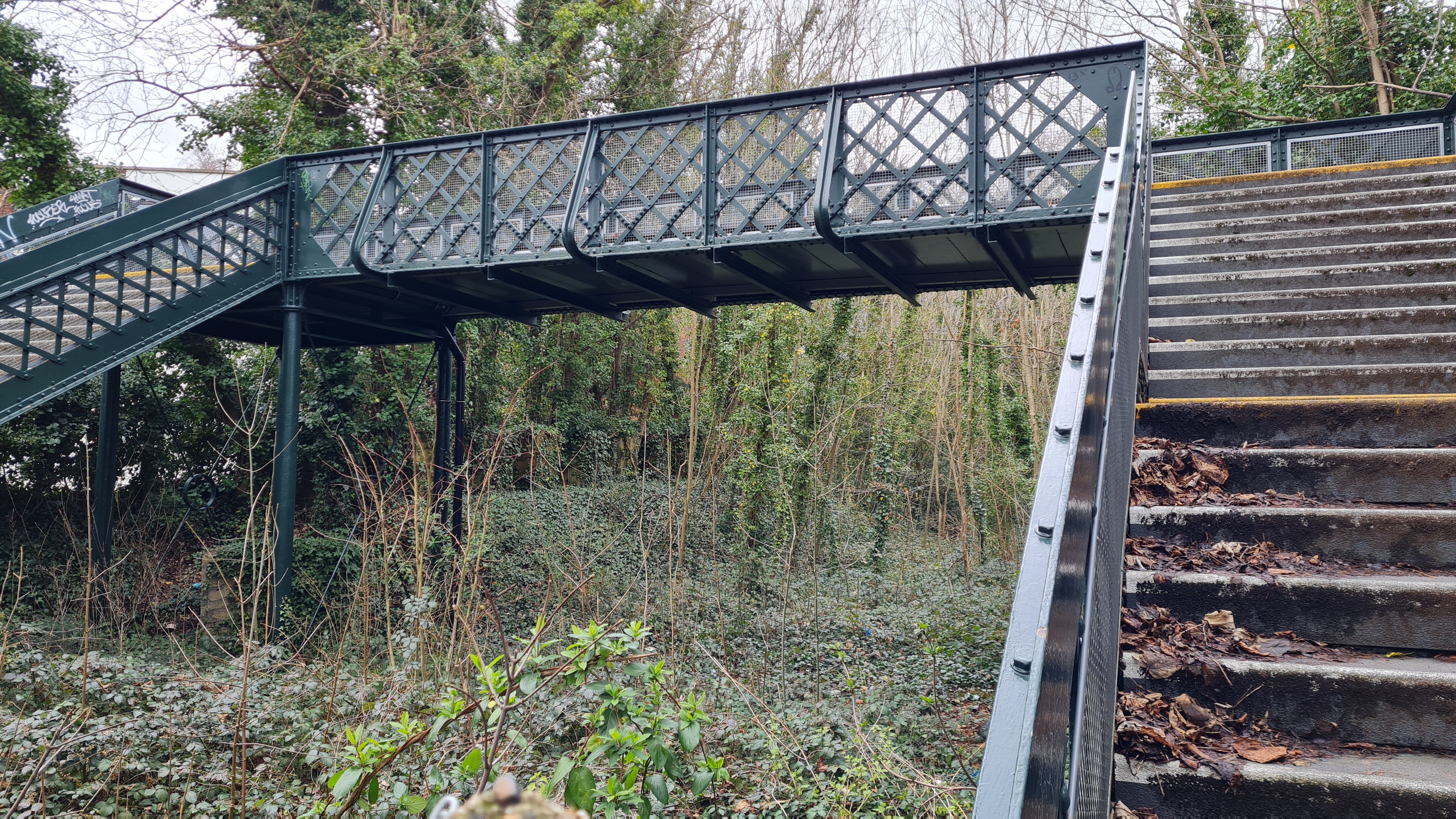
Passengers would have had to cross the Tooting tracks via a raised walkway to get to the West Croydon platform, as there was no footbridge on site. There was a long metal footbridge which spanned both lines south of the station. When the line closed in 1997, the footbridge was donated to the picturesque Corfe Castle station on the heritage line to Swanage.
The Station Today
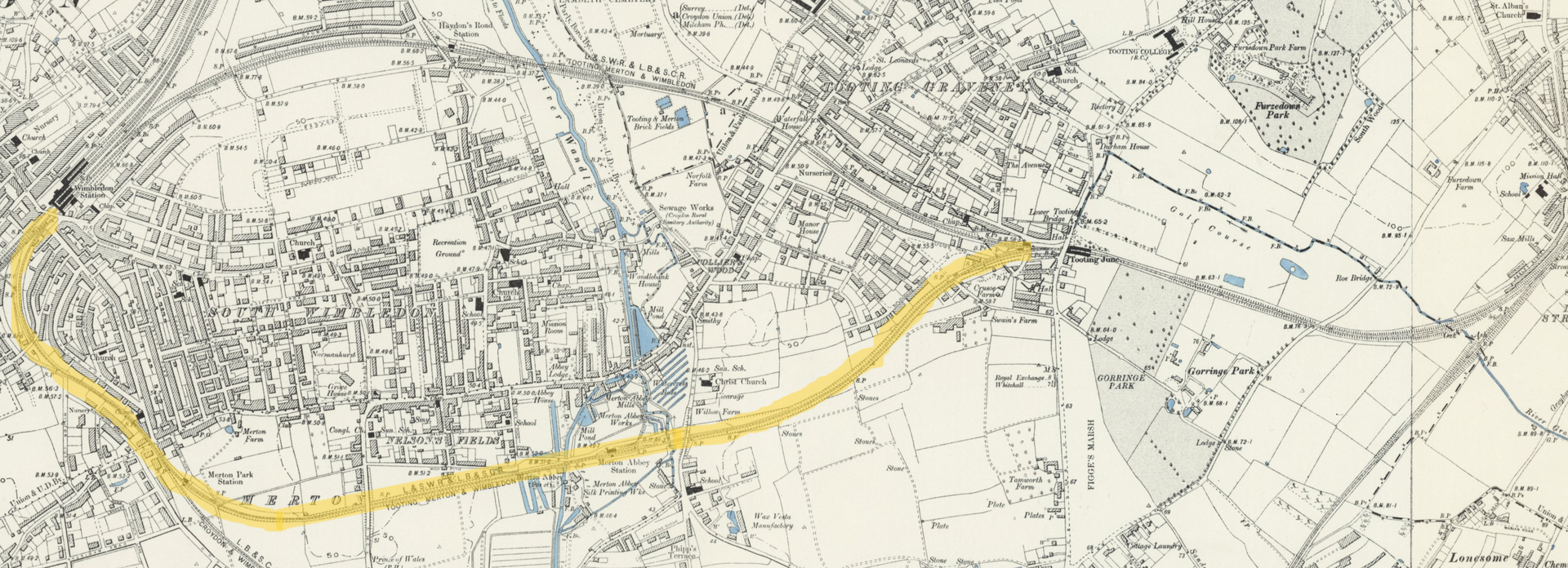
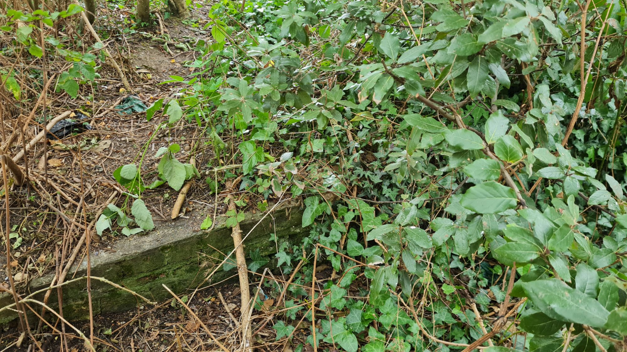
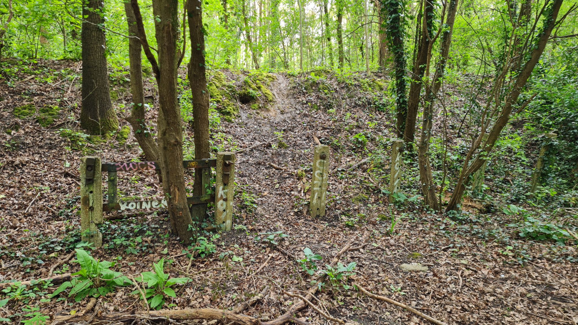
Though most of Merton Park station was flattened with the arrival of the trams, which required lower platforms, some remnants remain. The station master’s house can seen if you follow the path to the left of the southbound platform to Rutlish road. Continuing in a south-easterly direction and along another footpath takes you to a couple of playing fields. In a patch of trees to the right of the footpath is a section of the Wimbledon-bound platform, now overgrown and surrounded by trees and greenery.
Part 2 – Navigating Merton (Merton Park – Merton Abbey)
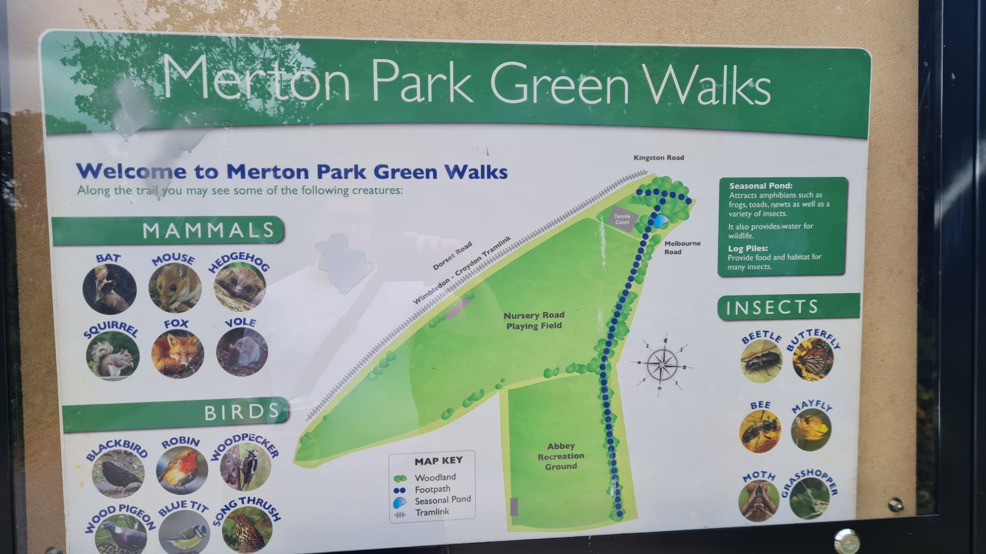
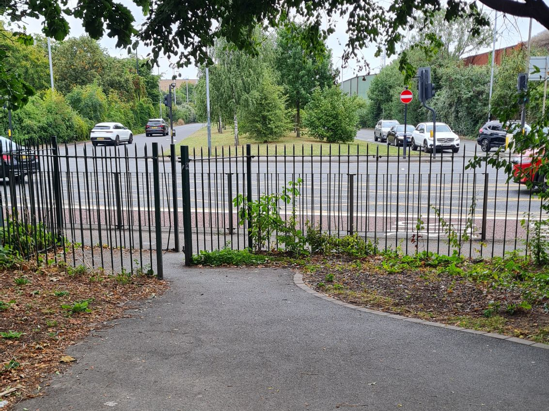
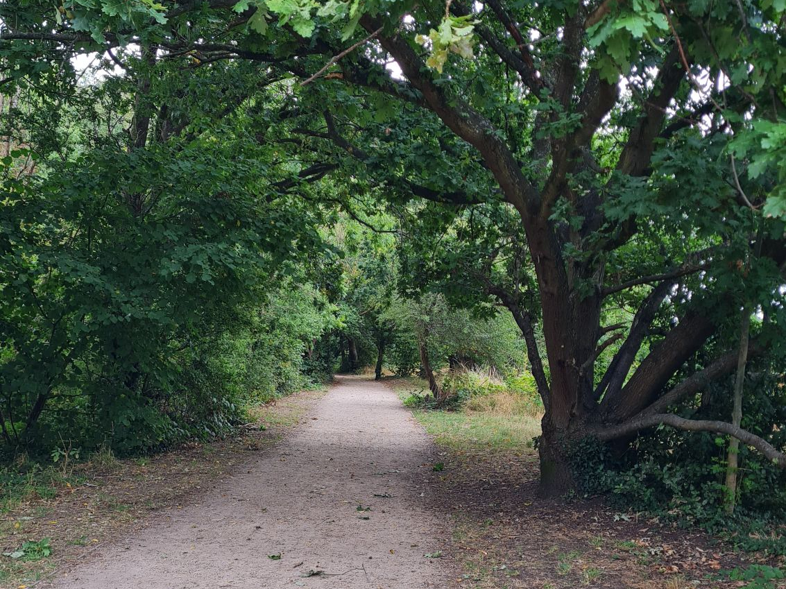
Leaving Merton Park station behind me, I walked along what is known now as the Merton Park Green Walks. This was easily the most scenic and pleasant part of the route, following the route of the line next to two recreational grounds. On a warm day, such as the one I did this walk on, it was a nice break from the traffic and noise of suburban London. Sadly, this path didn’t take me more than five minutes to walk, so I sat on a bench, dredged the remnants of my coffee, and took in the nice weather. The only downside to this was that I had reached the edge of a very noisy dual carriageway junction.
For the next half a mile or so, the route of the old line had been demolished to make way for Merantun Way. This dual carriageway was built to divert traffic away from Merton high street and, judging by the raucous and the number of cars speeding past, it succeeded in its aims. I instead had to take a detour through Jubilee Way, an industrial estate where small businesses sit between large warehouses. Old maps reveal that this estate used to have a toy factory on it, and this factory had its own designated sidings for the railway. It could be worse, I thought, as I passed a semi-destroyed taxi and a café which looked like it was where losing contestants from The Apprentice would visit.
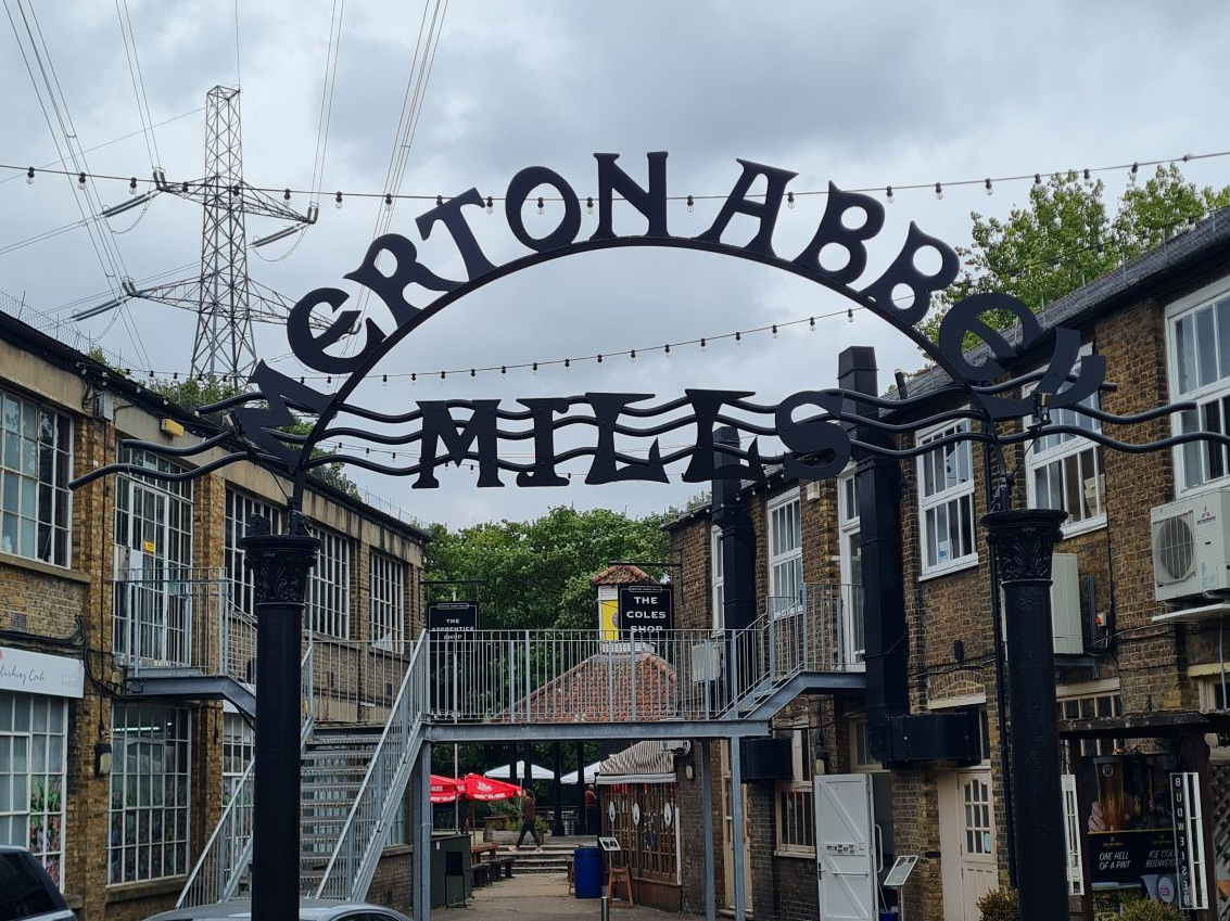
Mercifully, this section was cut short as I turned on to a dirt path that ran parallel with the River Wandle. There was a little bridge on this corner where an old couple were feeding a rather large brood of ducks from a bench. Passing some dog walkers and a very large electricity pylon, I stopped in my tracks at seeing the last thing I would expect in this part of London, an old waterwheel. I had reached the Merton Abbey Mills, a former textile factory which is described on Google as a “Crafts market in an 18th century setting”. It must have been the wrong time of day to visit, as it felt more like a ghost town than a bustling market.
Another thing that I visited at the wrong time was the Merton Priory Chapter House, a history museum only open on Sunday between 11am and 4pm; I must remember to visit this one day. Looking directly at the raised dual carriageway, it was at this point where Merton Abbey station would have sat, of which nothing remains.
Merton Abbey
Year Opened: 1868
Year Closed: 1975 (1929 to passengers)
History of the Station
Merton Abbey was quite a simple station when open, consisting of only two platforms. On one platform was the two-storey station master’s house, and on the other was a small brick shelter. It did have a considerable goods yard to accommodate the industry of the area. It was mainly for this reason that the line stayed open for freight decades after closing to passengers.
After the track was lifted, a team of archaeologists excavated the site of the old station and discovered the foundations of Merton Priory. This dates back to 1114 and, like many other monasteries in England, was demolished as part of Henry VIII’s dissolution when breaking England from the Catholic Church. Merton Priory was destroyed in 1538. In spite of its name, Merton Abbey station was never built on the site of an Abbey!

The Station Today
With the building of Merantun Way, the station was completely demolished, and nothing survives to be seen today. The station would have sat just after the roundabout taking cars into Merton Abbey Mills, parallel with a KFC joint. To the north of the station was a siding into the Merton Abbey Works, a textile printing factory. Now, a large Sainsbury’s sits where the factory was. This station is proof of how quickly the past can be demolished and modernised. Looking around the site, at the many cars on the flyover, the large electricity pylons and the fast food outlets, it is almost impossible to imagine this being the site of an old railway station.

Part 3 – To the Junction (Merton Abbey – Tooting Junction)
After a brief visit to the entrance of the sadly closed Merton Priory Chapter House, I walked back up some steps and along the footpath of the noisy dual carriageway. Traversing the rather busy junction of the A24 and the A236, which desperately needs an underpass of some sort, I took in what was surely an unhealthy amount of car fumes. Subsequent research of the area revealed another piece of transport history that predates even the Tooting, Merton and Wimbledon railway.
The road south from Colliers Wood tube station sits on the route of the Surrey Iron Railway. This railway did not run on steam, but rather horses. These would have led carts carrying coal and other raw materials between Wandsworth and Croydon. It opened in stages between 1802 and 1803 and, much like the steam railway, any remains would have been decimated by the building of the dual carriageways.
A well hidden path next to an outlet shopping centre took me behind houses and a waterworks, on a section called the Myrna Close Nature Reserve. According to the Merton Council website, this is an important habitat for butterflies and birds, and is dominated by a mixture of elm, oak, sycamore, holly, dog-rose and crack willow trees. The last time I did this walk, I navigated the roads of Colliers Wood, which certainly wasn’t as green, and was far less direct. Even though I was back under the shadow of the trees and could hear the occasional birdsong, I never felt that far away from civilization. A couple of times, the birdsong was drowned out by an obnoxiously loud car horn.
Nothing survives of the old railway and, after a few hundred metres, my temporary escape from society was cut short. The final section of the line was built on by a housing estate, and, once I had regained my sense of direction, it took me a few minutes to find my way through the houses.
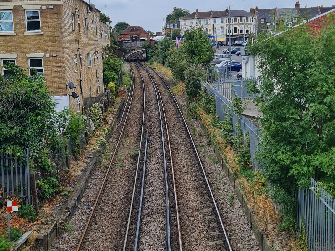
I was on the hunt for Lyveden Road, which I found at the end of Devonshire Road. Spotting an alleyway at the end of the road, I knew that I was on approach to the last station on this route, Tooting Junction. Walking up some steps and on to a rusted narrow footbridge, I was suddenly on top of the modern day Thameslink route and at the site of the old station.
Tooting Junction
Year Opened: 1868
Year Closed: 1968 (1894 to passengers)
History of the Station
Tooting Junction station could be best described as a victim of its own success. When opened, it consisted of four tracks and three platforms, one of which was a large island platform. There was a large goods shed and a coal yard on the Merton loop side of the station. Even in the 19th century, it was considered too small for purpose and was re-sited in 1894 to the east side of Mitcham Road. The re-sited station survives today as Tooting station on the Thameslink Sutton loop.
When the Merton loop was closed to passengers, the junction was severed shortly after, and became one long goods siding. Old photos online, taken as recently as 1968, show the presence of a couple of sidings with buffers, with the odd goods wagon poking into shot. The goods station was eventually closed in 1968 when the freight line was drawn back towards Merton Abbey, more than 70 years after the station itself ceased.
The Station Today
From the footbridge, you get a great view of the station’s footprint, and what remains to this day. To the side of the supermarket, there is evidence of a platform-like structure – this is most likely the remains of the later goods platform. The edges of the old Wimbledon branch station platforms can just about be seen, though some of this was lost when the brick facing of the Haydons Road-bound platform was demolished in 2016. The old station master’s house on the Streatham-bound line was sadly demolished in the early 2000s, despite being renovated only a decade prior. Now, a small block of flats sits there, which is certainly a downgrade both historically and aesthetically.
As my legs were starting to ache, I decided to take a train from Tooting station, and travel on the other branch of the Tooting, Merton and Wimbledon railway. There wasn’t too much to see on this short section to Wimbledon, so I enjoyed the air-conditioned Class 700 Thameslink train and looked out of the window. At Haydons Road station, there was a parallel drive which looked suspiciously railway related. Subsequent research has shown me that yes, there was a small siding with a coal depot sat parallel to the station at one point. Arriving back at Wimbledon, I managed to make the 5-minute connection to a southbound South Western Railway train and headed home.
Conclusion
After walking the line between Wimbledon and Tooting Junction, I believe that its ultimate fate and legacy are both justified. The existing branch through Haydons Road provides passengers with a wider spanning loop up to Sutton. Even here, a couple of the stations regularly feature on the top 10 least used in London, and I predict that stations on the Merton branch would have been used even less if still open today.
The extension of the Northern line to Merton and the trams terminating at Wimbledon provide commuters and residents with faster and more convenient ways into central London. This is not the first time that I have walked a route that was closed in part due to the London Underground; the fate of the Palace Gates (Alexandra Palace) was also tied in part to the creation of the Piccadilly line.
Walking the route of the old line took me past some pleasant sights, such as the recreational grounds near Merton Park tram stop. Even the diversion through an industrial estate proved something of a hidden blessing, as I may not have found the riverside walk and water wheel if I could walk directly along the route. However, much like the route to Palace Gates, these individual spots act as brief respites from the sound of road traffic. I would recommend walking the first half of this route up to where Merton Abbey station was. After that, there isn’t much to see aside from the Tooting Junction station remains.
The Merton branch of the Tooting, Merton and Wimbledon railway found initial success but was quickly overhauled by technological advances in ways to travel into central London. This is rather apt, as much of this line has been built over by more modern forms of transport. The question is, do these forms of transport better serve the community than the branch ever could?
Thank you for taking the time to read my account of exploring the path of the line between Wimbledon and Tooting Junction. If you enjoyed reading this piece, please do leave a like.
Have you ever explored the Merton branch, or have memories of the old stations on this line?
Do you have any recommendations of abandoned railway lines or transport hubs in London, or further afield, that are well worth exploring?
Please feel free to leave your comments below, or send an email to editor@thebloggingdj.com, and I will see you all next time for another Abandoned Railway Walk.
In the next Abandoned Railway Walk, I leave London for the first time and head deep into the Surrey Hills to explore a line that some locals want reopened. If you want to be notified when this post and other new posts are published, please do subscribe.
Walking Abandoned Railways – The Series So Far:

#3 – The Palace Gates Line – Seven Sisters to Palace Gates (Wood Green) – London, UK

#4 – The Edgware, Highgate and London Railway – Mill Hill East to Edgware
– London, UK
#5 – Parkland Walk – Finsbury Park to Alexandra Palace – London, UK

