
Since I was a boy, I have always been interested in the railways, especially the eras long past, when steam ruled the rails and stations were double or triple in number than exists now. I have recently begun to explore the abandoned railways in my home city of London, investigating remains that have been lost to time, and judging whether it would be beneficial for the lines to be reopened in the future. On a cold and windy day in February, I decided to follow the path of a line in the south of London, which took commuters from Elmers End to Selsdon, the Woodside and South Croydon Joint Railway.
A Brief History of the Railway

The Woodside and South Croydon Joint Railway (W&SC), as its name suggested, was built as a joint venture between the London, Brighton and South Coast Railway and the South Eastern Railway. The line was only completed in 1885, relatively late for a railway in London and, even from the outset, it had limited success, with two later built halts doing little to improve the passenger usage of the line. The commercial failure of the line even led to its closure during World War I, in an attempt to save money and resources for the war effort. Though money was spent on the line in the 1930s to electrify it, passenger numbers remained low. It actually survived the Beeching cuts of the 1960s, but didn’t last much longer, with through services to central London withdrawn in favour of a shuttle service in the 1970s, and the line finally closing in 1983. Much of the line from Elmers End to Coombe Road was reused in the 1990s by the London Tramlink, with the majority of the remaining structures destroyed though, as I found out, there was still plenty that can be seen today.
Exploring the Line
Part 1 – Starting the Branch
The branch started at Elmers End station, with the branch’s bay platform now used by the London Tramlink, as the majority of the line has. Much of the platform remains unchanged from 1997, when the branch line to Addiscombe closed. Therefore, I opted to skip this station and headed straight for the first intermediate and disused stop on the line. With the weather threatening bitter winds and downpours, I traversed the mile or so from Selhurst station, passing the extensive carriage sidings as I headed south-east. On the way, there was a house with a blue plaque, informing me that Sir Arthur Conan Doyle, known for his writings of the fictional sleuth Sherlock Holmes, lived there for a few years in the 1890s. I wonder whether he travelled on the line between Elmers End and Selsdon, at the peak of its usage. As I pondered this, I crossed the main line near Norwood Junction and soon found myself at the first abandoned station on the route, Woodside.
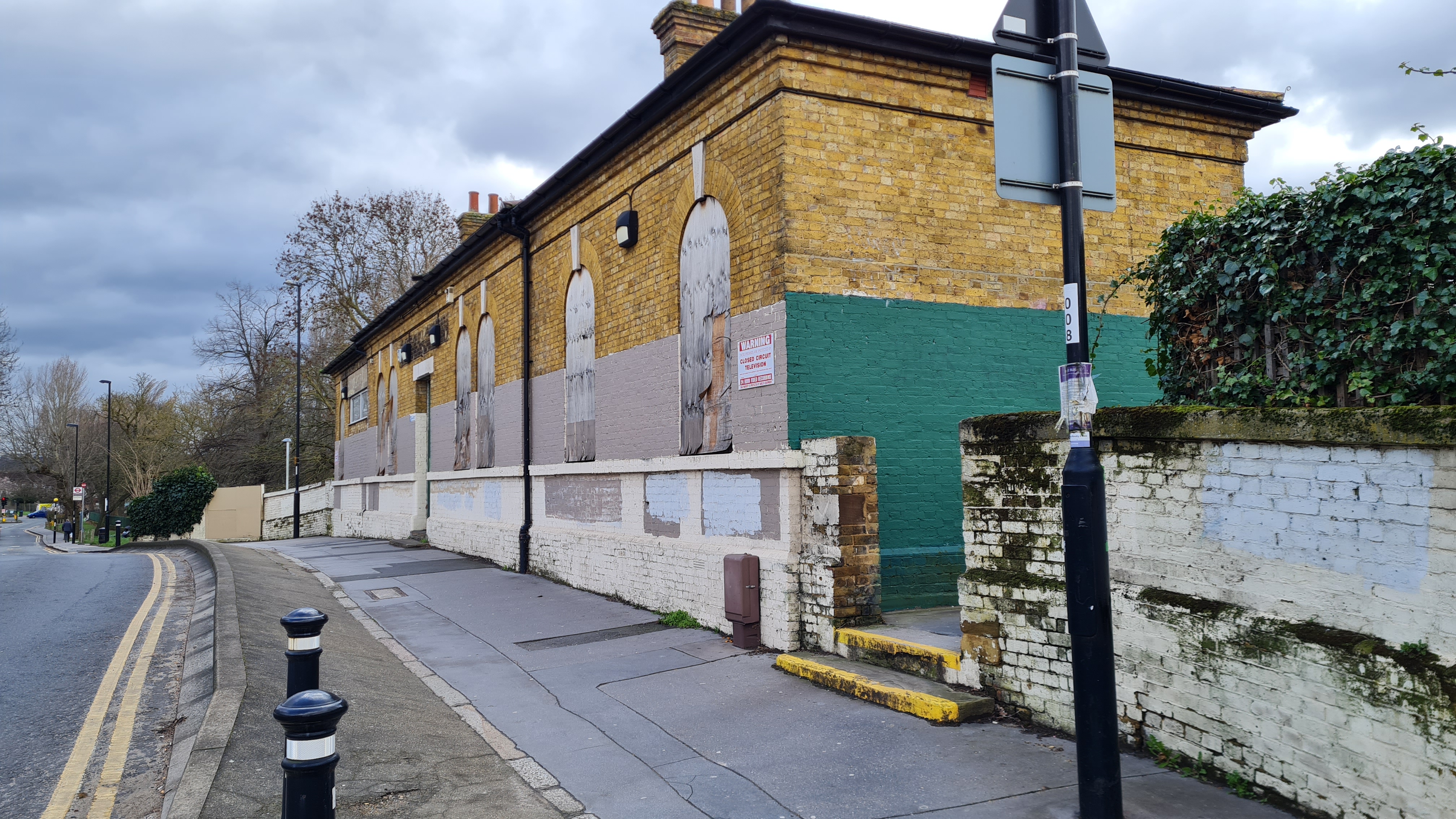
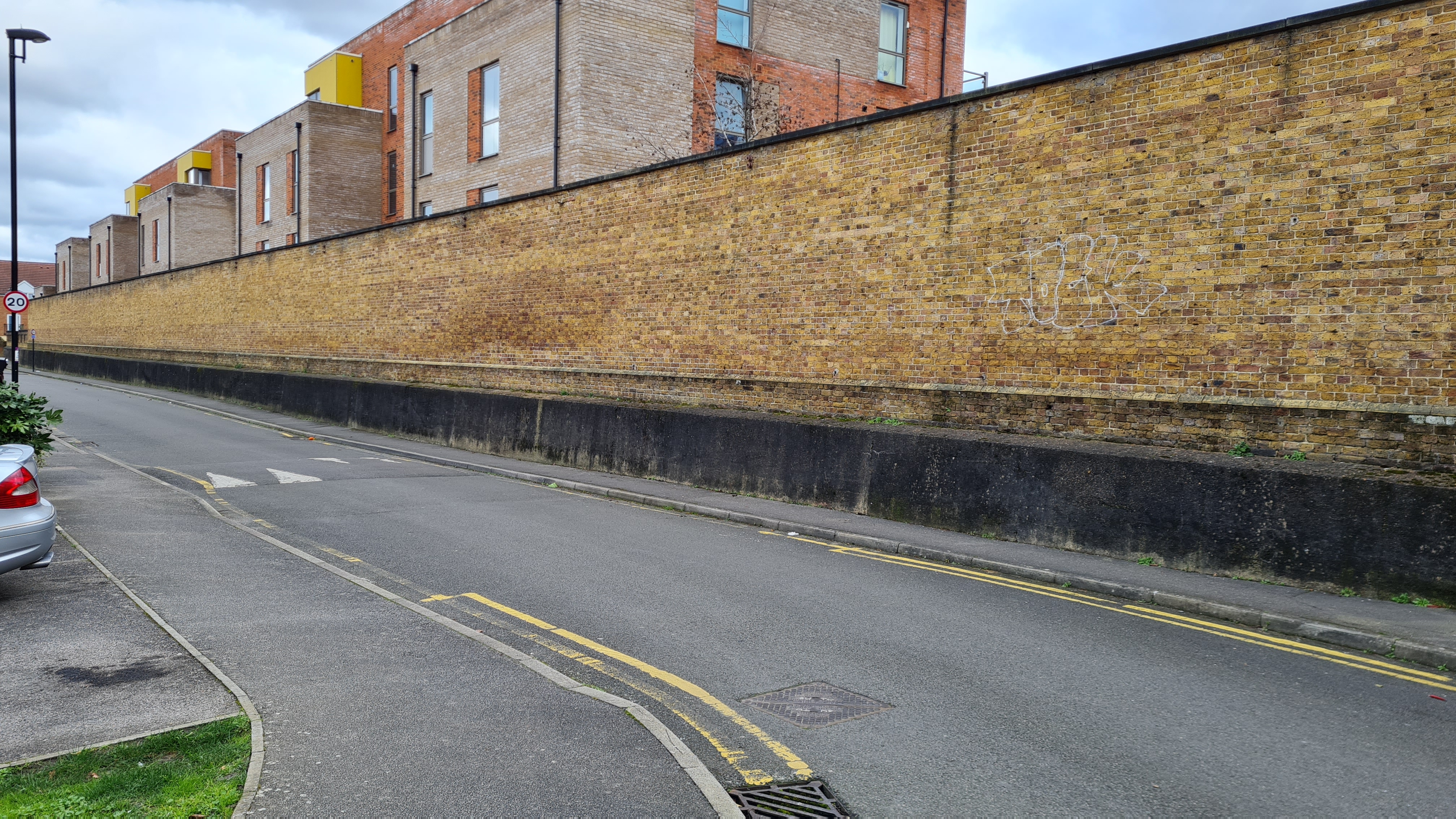
The station building itself has been boarded up, though the yellow bricks still look magnificent, in spite of the lower half being painted in ugly shades of grey and green. To one side of the building is a faded sign that reads Sanderstead, the still existing National Rail station that would immediately follow Selsdon Road on the line down to East Grinstead. Woodside tram stop is less than a hundred metres from the station building, and passengers taking the tram towards Elmers End would descend a set of steps next to the old building. It is a shame that the old station building is now only a relic of the past, though a timely reminder of how quickly the railway and transport landscape changes in London. However, research revealed that one of the dismantled platforms had been donated to the Swanage Railway, a line I am very familiar with from family holidays in years gone by, for use at Herston Halt.
Part 2 – A Detour to Addiscombe
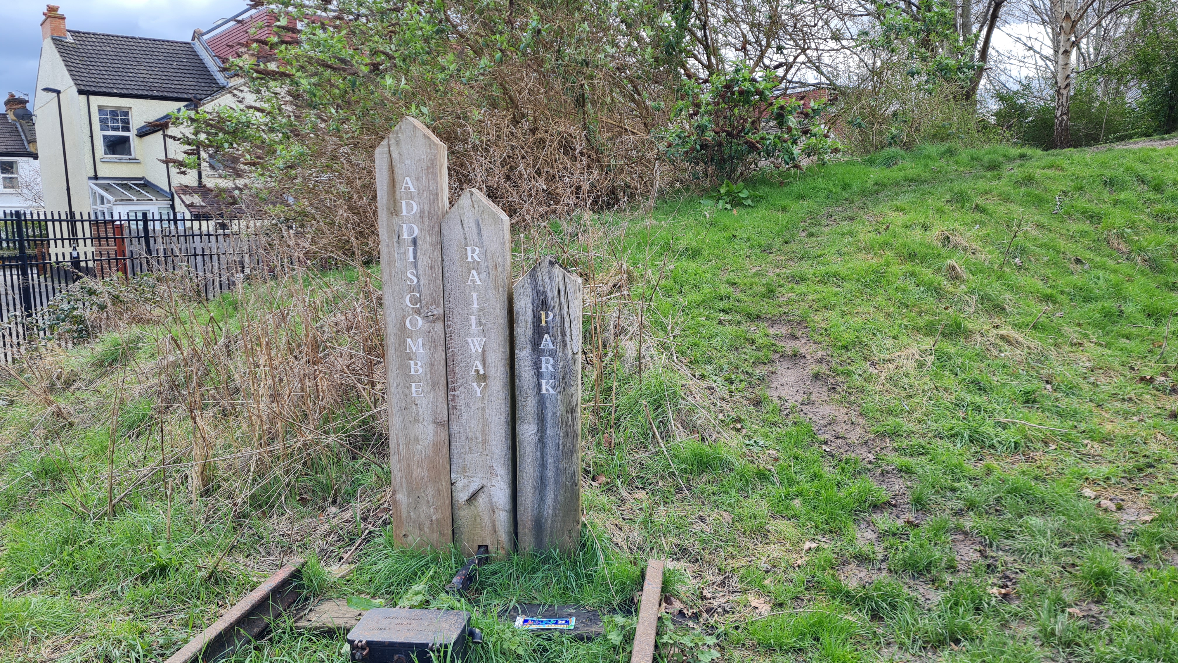
The next tram stop on the line, Blackhorse Lane, was previously only a row of allotments and had no station presence, but did mark a deviation in the line for a separate branch line that terminated at Addiscombe. Evidence of this deviation is still visible, with the branch converted into Addiscombe Railway Park between 2007 and 2010. Ordinarily, this would take walkers right to the site where the old terminus was, but the second half of the path was closed owing to winter improvement works. I will have to return to this park in the warmer months, as community gardens adjacent to the path would be in full bloom, courtesy of the Friends of Addiscombe Railway Park (http://park.addiscombe.net/index.asp). I did manage to snap a picture of a sign that appears to be made of old railway sleepers, before cursing my luck and heading back on to the roads as I hunted for the footprint of Addiscombe station.
The branch lasted several years longer than the W&SC, though was in a dilapidated state in its final years, closing in 1997 and the station being demolished in 2001, in spite of a petition to turn it into a railway museum, which was opposed. The station footprint is now taken up by the East India Way housing estate, with only an impressively large retaining wall and a few other structural remnants remaining. Be on the lookout if you do live in the housing estate, as the Friends of Addiscombe Railway Park speak of a ghost that haunts the site of the station, possibly a driver who lost his life on the line.
Considering that the station would have been almost halfway between today’s tram route and the bustling East Croydon, it is a shame to see a previously active station flattened and not turned into part of the Tram network, as many other stations in this area were. On the other hand, it would have been an exceedingly short route for the trams to take from Elmers End; Lloyd Park, which is slightly further down the tram line, is better placed as an intermediate terminus.
Part 3 – Following the Trams
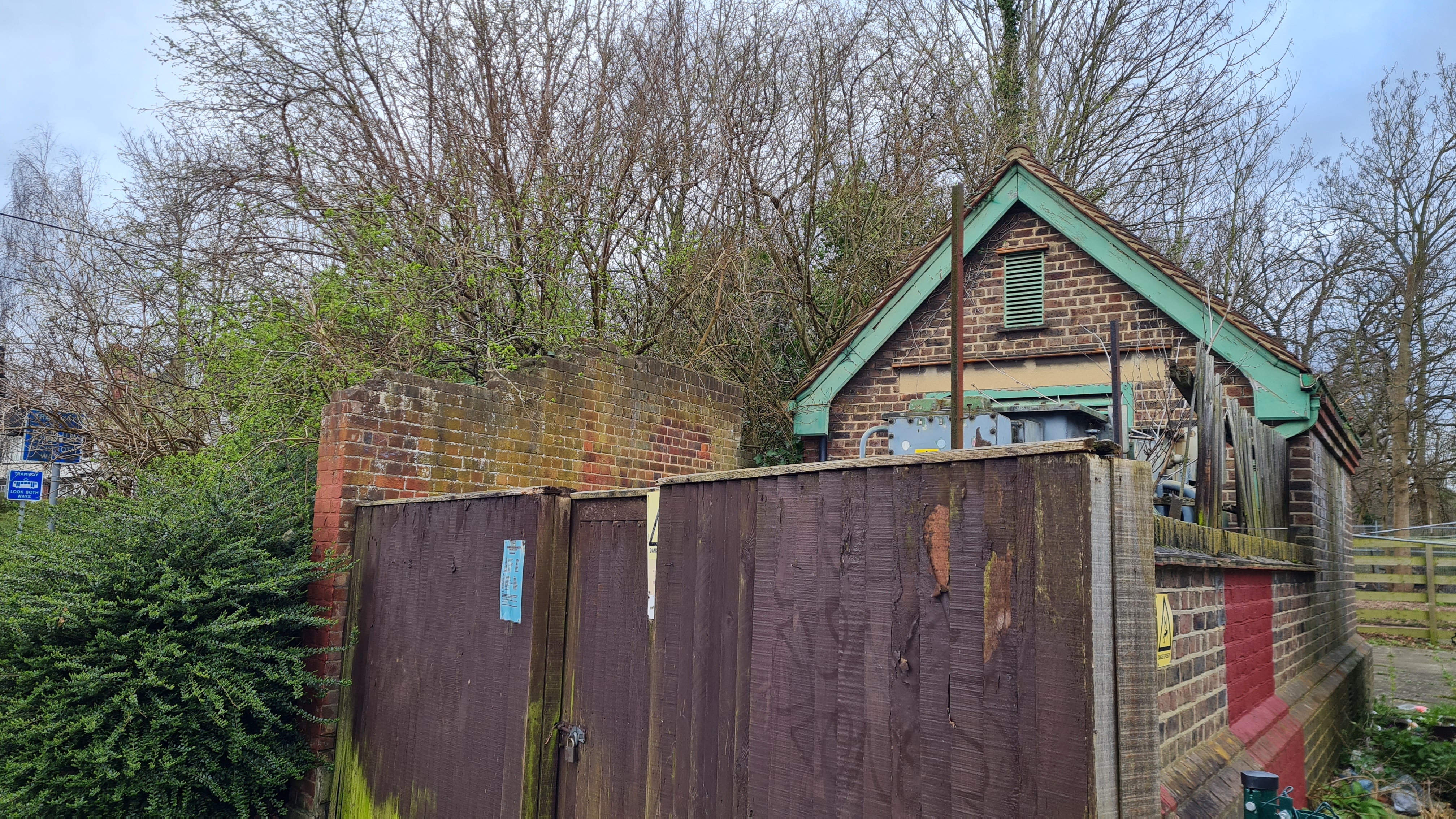
Turning left out of the cul-de-sac and away from central Croydon, I traversed a bustling street to retrace the path of the tramway and footprint of the old line. Whilst the trams run at road level, with traffic lights alerting road users of their approach, the Woodside and South Croydon railway ran along an embankment, with bridges crossing the roads demolished when this was flattened to make way for the trams. This can clearly be seen on the next immediate stop from Woodside, Bingham Road, about a ten minute walk from the old Addiscombe station and one minute away from Addiscombe tram stop, which itself is on the site of the old Bingham Road station, re-sited in 1935. Old pictures of the station reveal concrete platforms with waiting shelters at the road bridge end, but all that can be seen now is a section of a brick wall adjacent to the tram crossing, where passengers would have traversed a set of steps which led to the platform.
The tramway follows the alignment of the old line in a fairly deep cutting, which meant that it was time for the longest and steepest climb of the route. Ahead, at Sandilands tunnel, the tram route steers sharply to the right towards Sandilands and East Croydon. Trams coming from Sandilands would turn sharply in the opposite direction and back on to the pathway of the old line. Both of these can be seen clearly from the road above; it will always be strange to me to see road signs which denote a sharp turn in a railway cutting. As the line is live, you cannot get close to the tunnel portal, but it did mean that I found a lovely part of London in the Sandilands and Shirley Park area, where pavements vanish, roads widen and the houses and their gardens expand exponentially – it is hard to believe that this slice of the countryside is maybe a ten minute drive from the traffic and noise of East Croydon station.
Lloyd Park itself is extremely lovely and expansive, full of dog walkers and joggers even on a weekday. By this time, the sun had started to poke its head out of the clouds, making my stroll through the heart of the fields feel rather pleasant, and a welcome escape from the endless traffic and pedestrians. The tram route turns sharply at the edge of Lloyd Park to the tram stop of the same name and out towards New Addington, whilst the old line would have continued straight. Right before this sharp turn was where Coombe Road station would have been, now completely flattened by housing developments and roads.
Part 4 – The Gems of the Branch
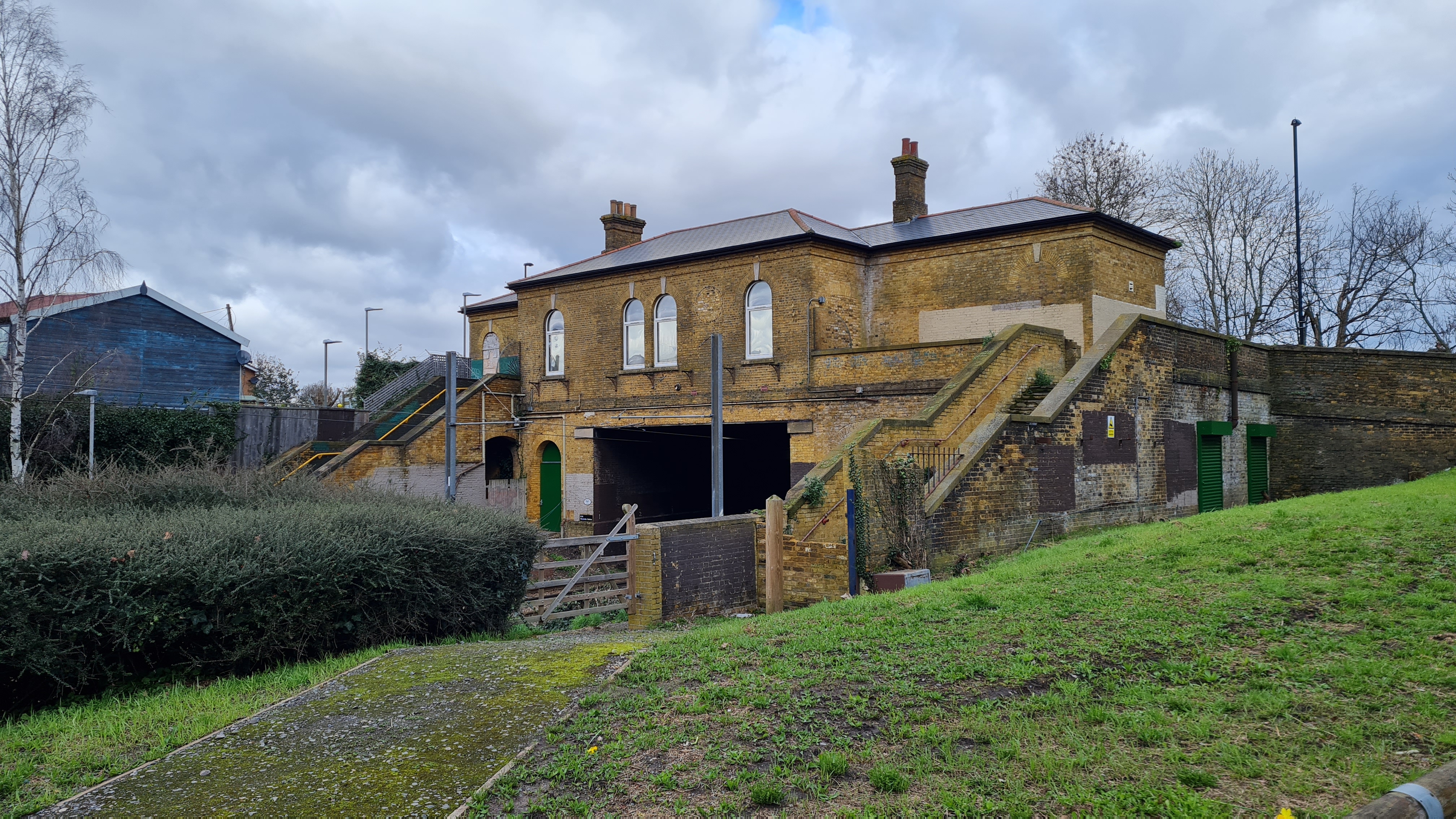
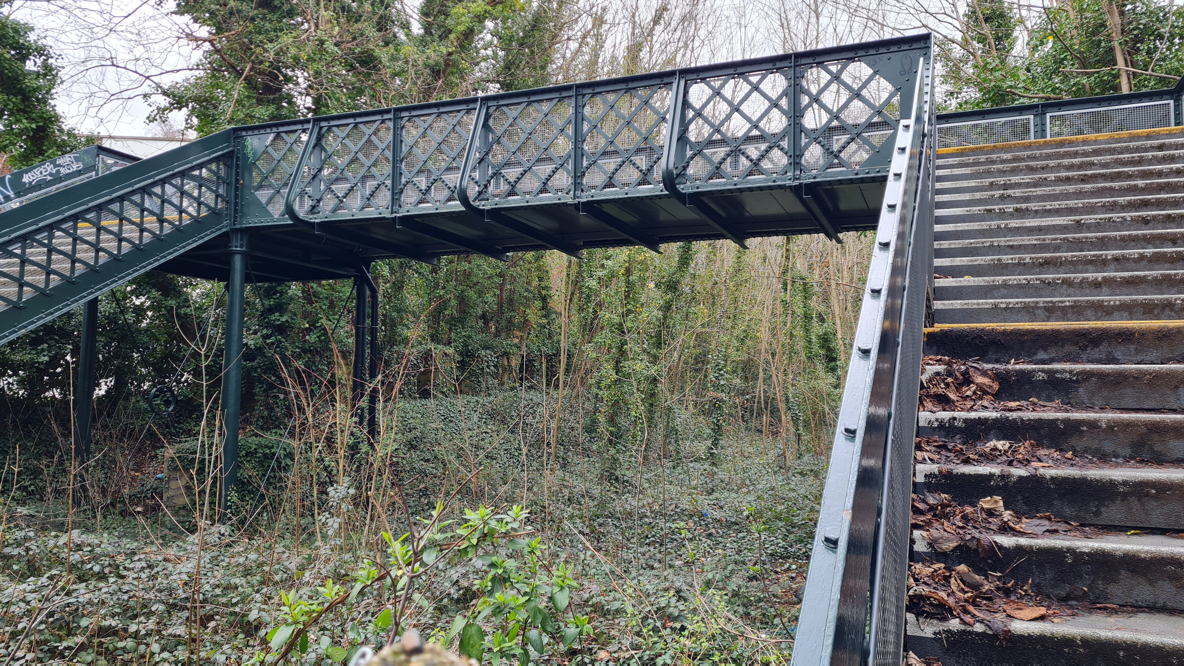
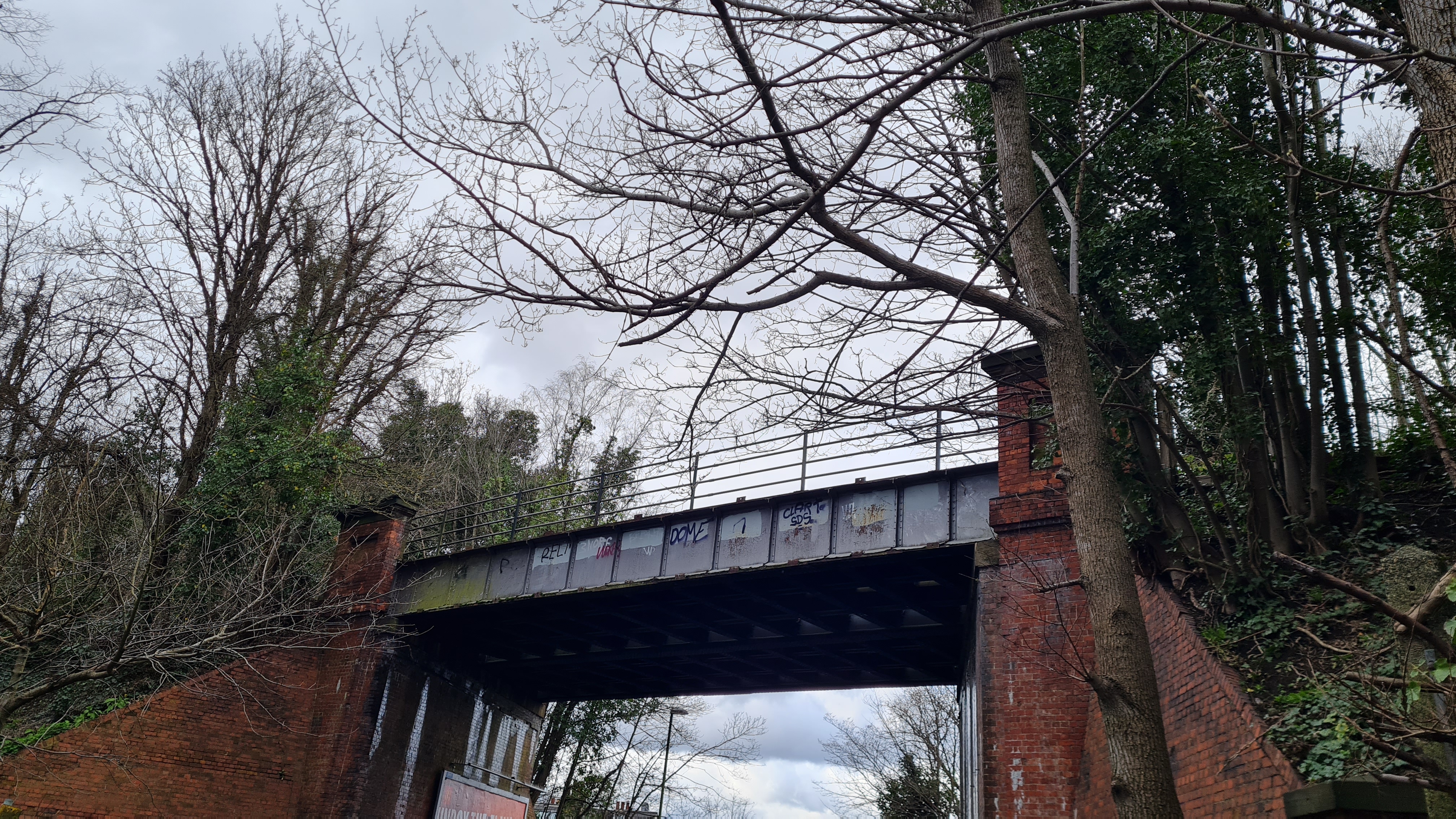
The railway would have crossed the road over a bridge – the retaining wall and embankment opposite Coombe Road station still exists. Going up another relatively steep hill, the next station on the route was the smallest and was actually open for just nine years, but remains the most spectacular on the whole branch. This is Spencer Road Halt, hidden down an alleyway and in the middle of a wooded area, and therefore is a gem only locals and railway enthusiasts would know about. The wooden platforms were pulled up decades ago but, remarkably, the metal station footbridge still survives. This carries the Network Rail signage, and was actually refurbished a couple of years ago.
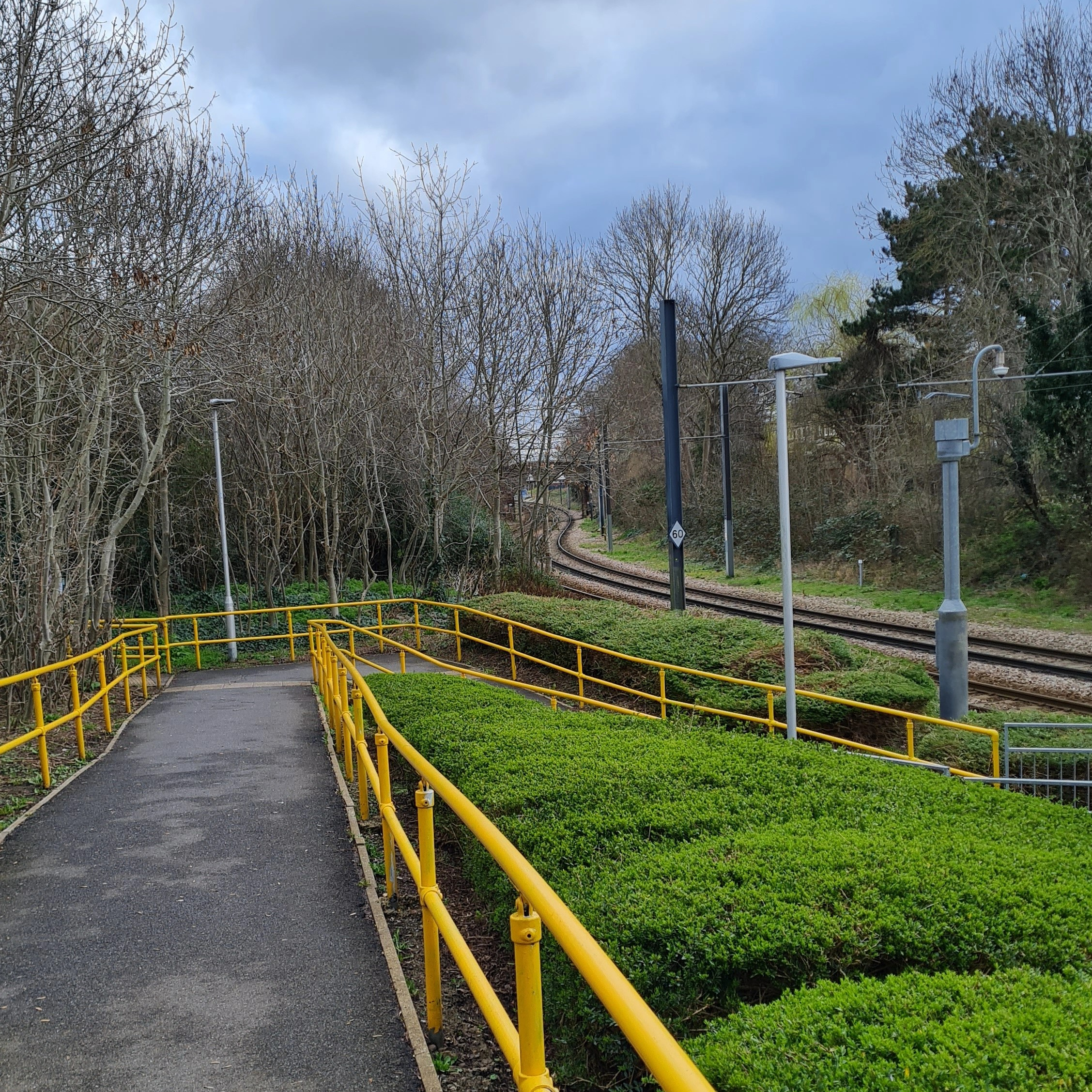
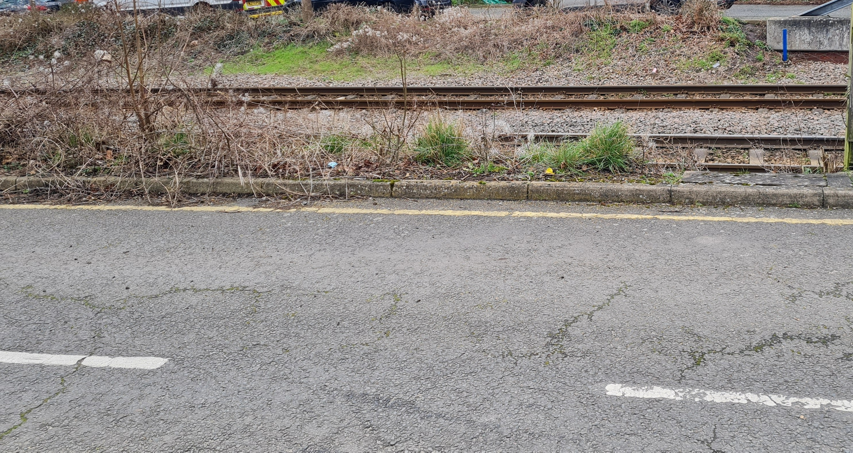
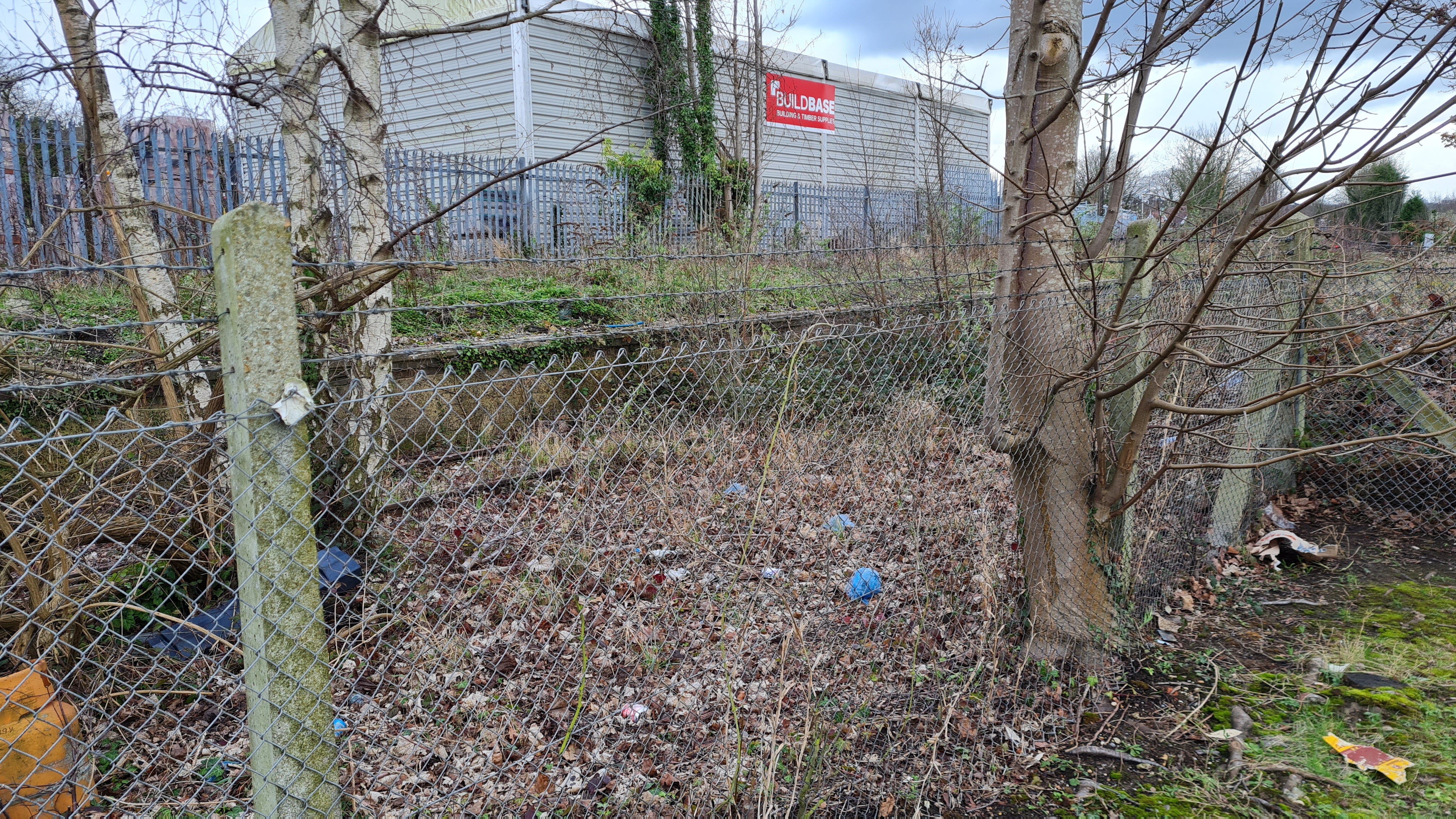
Approaching the edge of the bridge at track level, you can see the rusting metal double track still there, slowly being taken over by nature, but at such a rate that it suggests that occasionally this gets tidied away by someone. It does beg the question of why Network Rail continue to maintain this site – maybe it is less effort and more affordable to maintain the bridge for people to traverse, rather than pulling up the tracks, or is there a future plan for this route that has yet to be revealed? Standing at the top of the bridge, you can clearly see the route of the line. If you were to visit just one sight on the branch, I would recommend this one.

Just one minute away is another spectacular sight, a railway bridge that passes some 10-15 metres above Croham Road. It would have been quite the sight to see a steam train slowly pass over on departure from Spencer Road Halt, or on approach to the end of the branch, its steam rising high over the houses and trees. A quick glance on Google Maps shows the old tracks are still on top of the bridge, and a sign suggests that National Rail continue to maintain it. By this time a fine drizzle had finally begun to fall and, not wanting to get completely soaked far from an (active) station, my pace increased as I approached the final abandoned station on my route.
Before reaching the final station, a footbridge at the end of Dornton Road gave me another chance to look down at the old tracks being reclaimed by greenery. Heading to the end of Birchend Close, a private but accessible housing complex, I reached the end of the branch line at Selsdon Road (later just known as Selsdon). On my right side was the still live line that took Southern services down to Sanderstead and East Grinstead, with the remains of the platforms visible. The same was true on my left, the bay platform for the branch to Woodside, with sidings to an old oil storage facility and goods yards still apparent. Considering the old station stood only a few hundred metres from the still active South Croydon station, the closure of the Woodside branch meant that this station was largely unnecessary.
Final Thoughts
Throughout its tenure, both the Woodside and South Croydon Joint Railway and the Addiscombe Line struggled with passenger numbers, so its closure made sense from a financial standpoint. With many railways that were closed, the connected communities became inaccessible and heavily dependent on the roads to get them around, often on a roundabout route. Therefore, it is great to see that the line has found a second life on the London tram network, ensuring that the communities served in this part of London remain connected, and that the legacy of the line continues. There is still much to see along the route of both lines, so I would recommend an exploration if you are ever in the area.
Thank you for taking the time to read my account of exploring the Woodside & South Croydon Joint Railway. If you enjoyed reading this piece, please do leave a like. At the time of publishing, I have since explored the route of another abandoned railway in London, this one to the north of the city – if you want to be notified when this post is live, please do subscribe.
Have you ever walked the path of this line yourself? Do you have any memories of when these lines were still active? Or, do you have any recommendations of abandoned lines in London or further afield that is well worth exploring, particularly those with interesting remnants or sights? If any of those apply, please leave a comment below or send an email to editor@thebloggingdj.com – it would be great to hear your experiences!
