
Ever since my first childhood visit to a railway museum, I have been interested in the railways of the UK. The romantic mystique of steam trains crossing the country, stopping off at quaint villages and seaside towns, was particularly appealing. Passing into adulthood, I still have that interest of the railways, but it has shifted to a more historical basis. The 20th century saw a massive cull of railways deemed difficult or expensive to maintain, especially in lesser served areas. Many of these lines no longer see any trains stopping at their platforms. Instead, their remains lay abandoned and forgotten, or buried under modern infrastructure.
In this series, I explore what remains of the abandoned railways of the UK by foot. I investigate their histories and their ultimate fates, and I assess whether these lines should be reopened one day.
This post focuses on the most famous of all the abandoned lines in London, between Finsbury Park and Alexandra Palace. Known today as the Parkland Walk, this snakes through north London and terminates at the base of Alexandra Palace. This route definitely lived up to its reputation.

A Brief History of the Line
The line between Finsbury Park and Alexandra Park was constructed in stages. The first section, between Finsbury Park and Highgate, was built in the 1860s by the Edgware, Highgate and London Railway. Upon departing Highgate, trains would branch off towards Edgware or Chipping Barnet at Finchley. Locals and transport aficionados will recognise this route as being that of the modern day Northern line on the London Underground.

Even before the line opened in 1867, the smaller railway company faced mounting costs to get the route completed. This led to the line first being sponsored and then purchased by the much larger Great Northern Railway (GNR). Separately, the Muswell Hill & Palace Railway (MH & PR), opened their line in 1873 between Highgate and Alexandra Palace.

After early success, passenger numbers on the MH & PR dropped and the terminus station closed several times. A fire at Alexandra Palace in 1875 did not help their cause. Intermediate stations were added to the line in the face of suburban growth. Whilst this worked for a time, this wasn’t a long term solution and the company continued to lose money. This led to the MH & PR’s section of the line being bought out by the GNR.
In 1935, the London Passenger Transport Board proposed acquiring the Alexandra Palace branch as part of their Northern line. Readers would know this company today under the name Transport for London. The lines in and around Highgate were set to be electrified as part of the proposal. Unfortunately, improvement work on the Alexandra Palace branch was halted by the Second World War. When the War ended, lack of funds after mass repair jobs meant that the electrification work was abandoned. Limited progress was made in the section of the line between Mill Hill East and Edgware before also being abandoned.
After the war, the service pattern between Finsbury Park and Alexandra Palace was reduced to a shuttle service. After years of low passenger numbers, the line was finally closed to passenger traffic in 1954. The section between Finsbury Park and Highgate remained open until 1970 for transfer of London Underground stock. Though the tracks were lifted in 1972, this wouldn’t be the end for the line. Two sections were converted into fully accessible pathways, and these were officially opened in 1984 as the Parkland Walk.
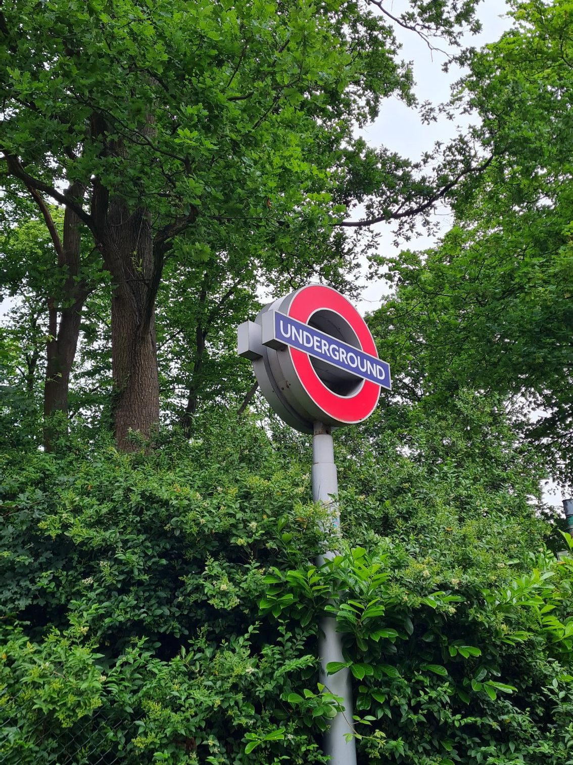
On an overcast May afternoon, I set off from Finsbury Park station to explore the length of this abandoned railway.
Exploring the Line
Part 1 – Parkland Walk South (Finsbury Park – Highgate)
The threat of drizzle loomed over me as I left the shelter of Finsbury Park station. Pictures reveal the existence of a small remnant of platform here, which the Alexandra Palace trains would have departed from. Next time I am in the vicinity, I must remember to stop by and investigate further.
The Parkland Walk starts a couple hundred yards north of the station. This gave me the opportunity to walk through Finsbury Park itself, which was fairly pleasant and full of joggers. About halfway down the path, I turned left onto a narrow bridge and over the East Coast Main Line. A freight service was heading north as I crossed, its freight containers a multitude of colours. Being a railway geek, I noted that the bridge was painted in now faded blue and red, which surely a remnant of the days of Network South East. I seem to have an issue with high bridges in this series, but unlike that high foot bridge between Mill Hill East and Edgware, there was thankfully no dizziness as I crossed.
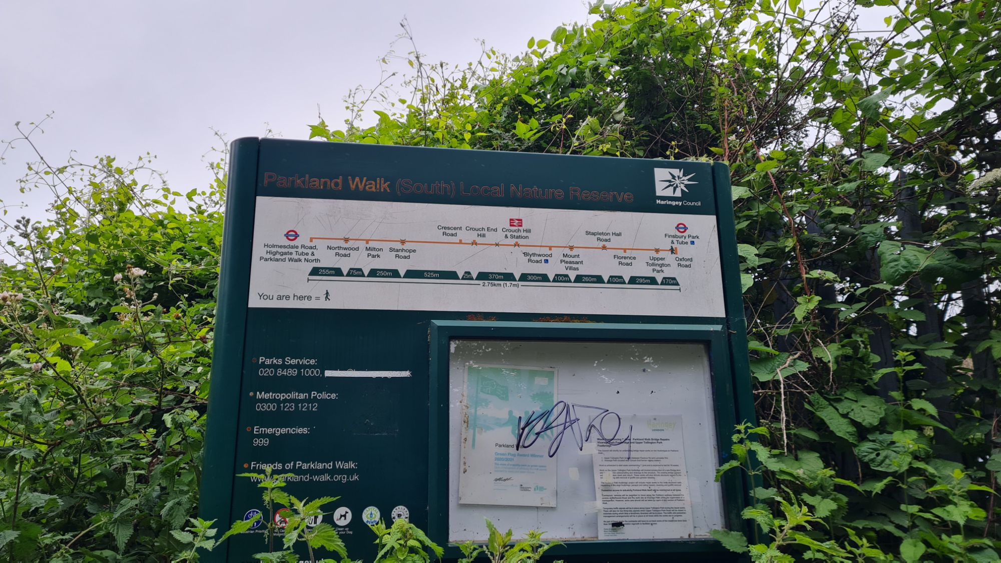
Once I had crossed over the ECML, I turned right and passed a helpful sign informing me that I was now on the Parkland Walk. Though the track was lifted when the line closed, its high embankments and deep cuttings had not been flattened. This first section started as a tree-lined path, but provided some nice views when the path opened up and crossed high above the roads on bridges. These Victorian-built structures stand tall and proud among more modern architecture, a reminder of their brilliant effectiveness.

Upon one of these, more a small viaduct than a bridge, there was an especially impressive interweaving of layers. The Parkland Walk stood high above the road, which in turn stood above another railway. The bright orange train rumbling below indicated that this was the London Overground line between Crouch Hill and Harringay. This spot reminded me of the brilliant intricacies of London, its infrastructure built directly on top or below existing structures. It was on this bridge that Stroud Green station would have sat; alas, virtually nothing from the station itself remains.

Stroud Green
Year Opened: 1881
Year Closed: 1954
History of the Station
Stroud Green was built several years after the line was opened to attract residents from the expanding suburbs. It had two platforms, as with other stations on the line, with a structure made of timber. After the line closed in 1954, it stood derelict until a fire in 1967, which led to its demolition. The most obvious remnant of this station is the adjacent station master’s house, now painted white. There was a timber lattice under one of the arches, which research suggests was part of the old platform supports. As the space between the house and bridge looked like a private garden of some nature, I didn’t investigate further.

It was at this point that the continuously grey weather made me crave a coffee. So, retracing my steps and negotiating a slight slope, I found myself back at road level. Whilst admiring the magnificence of the bridge, I spotted The Goods Office, an all-day restaurant and bar. Inside, it had old railway memorabilia and photos on the walls – definitely somewhere I should visit again. As I had only walked a small part of this line, I grabbed a mocha to go and pressed on.

After passing over another couple of bridges, the path flattened out and headed into a wooded section. The roads went from being far below the path to running over it. Online research had told me that these bridges were known for their graffiti. Unfortunately, scaffolding to reinforce the bridges covered all trace of them. There was an odd cube-shaped building in this section that intrigued me, as it looked railway-related rather than residential. This was going to be an electricity sub-station for the line once it had been incorporated into the London Underground. Thankfully, this building did not get destroyed and has instead found a new life as a giant adventure playground.
A large brick wall was stood to the right of me, and contained a series of alcoves. The brickwork suggests that this was an old retaining wall for the line, though I do not know for certain. As I passed one alcove, I was greeted by a friendly-looking forest folk hiding away. This is The Spriggan, a famous sculpture created by Marilyn Collins in 1993 as a commission piece for the walk. There are rumours that this mythical figure inspired the Stephen King short story ‘Crouch End’, though this has been debunked. Far more of a certainty was that encountering this fae folk meant I was on approach to Crouch End station.

Crouch End
Year Opened: 1867
Year Closed: 1954
History of the Station
Crouch End station is undoubtedly one of the most eye-catching landmarks on the Parkland Walk. It was one of the original stations built by the Great Northern Railway on their line to Edgware. When open, it consisted of a brick building at street level and two concrete platforms. Like Stroud Green station, its platform buildings were made of timber, and there was a siding behind the Edgware-bound platform. The line continued to be used after closure for London Underground stock movements, but the station itself became dilapidated. The platform buildings were demolished in 1966, with the street level building surviving another decade before being demolished in 1977.
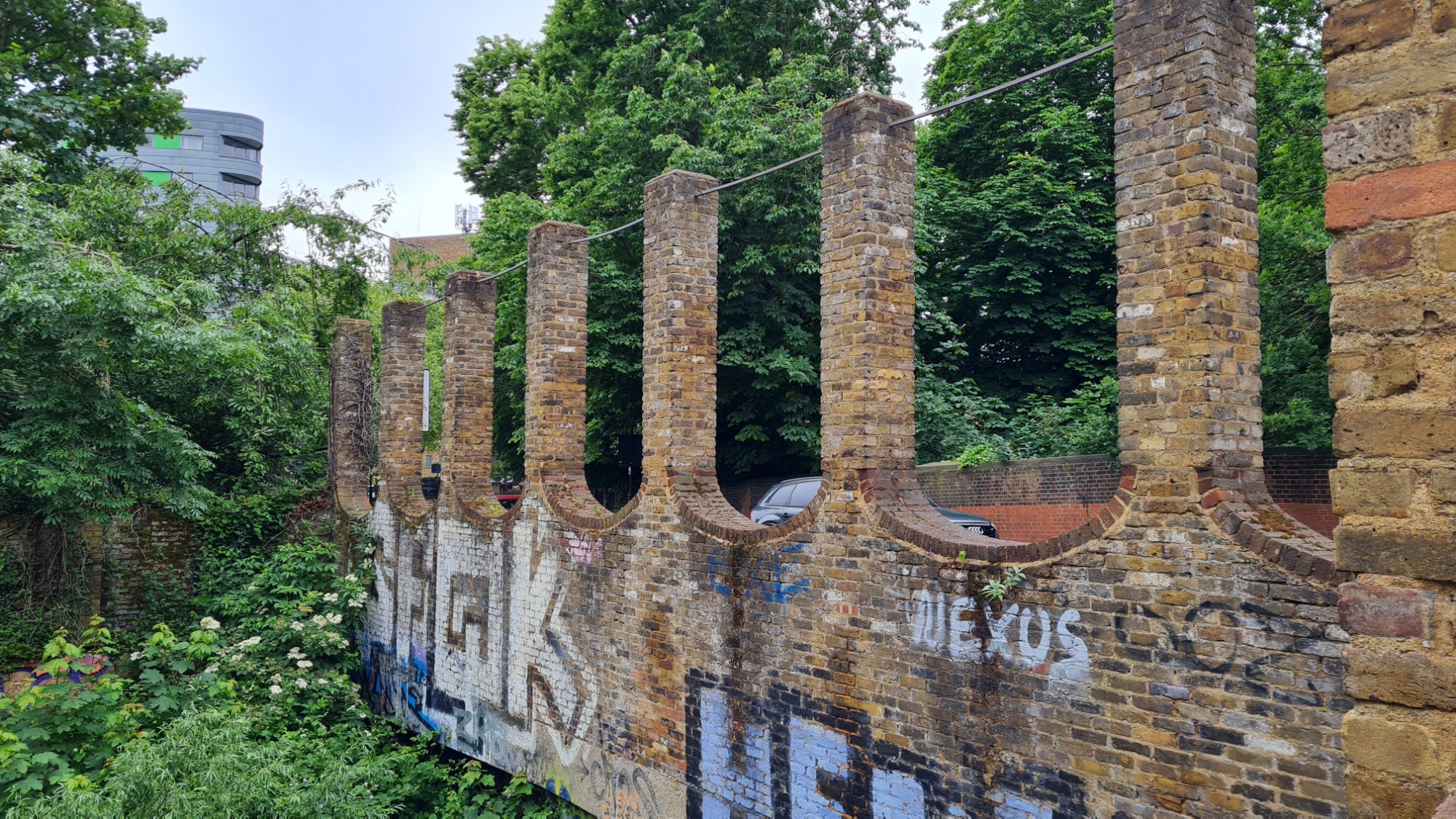
The Station Today
What makes Crouch End station such a landmark as that both of the concrete platforms still survive to this day. You can walk along these and imagine what it would have been like for passengers in the mid-20th century. The awning of trees and greenery makes sitting on one of the platform benches a peaceful experience. The road crosses a bridge at the western end of the station, upon which are the the street level building remains. Some stairs at the end of the Finsbury Park-bound platform give a clearer view of the narrow pillars, stretching up to the sky like fingers. A footbridge at the eastern end of the station provides a great view of the length of the old station.
I have done the Parkland Walk before and, compared to then, I saw how nature was reclaiming the site. Much of the central path, where the tracks would have laid, was covered with nettles and other foliage. The outside of the platforms were also overgrown, meaning I had to walk closer to the edge than last time. Though trains have not run along this line for half a century, my body still amusingly reacted with nerves as I passed precariously close to the edge. The heavier dose of greenery did not detract from the simple beauty of a man-made structure now reclaimed by nature. I would highly recommend a visit to the remains of Crouch End station.

Leaving behind the remains of Crouch End, the tree cover felt thicker than ever before. Lining the path I spotted concrete posts, a sight familiar to me from previous abandoned railway walks. These posts would have carried the electricity current for London Underground trains. If you look out the window of a tube train today, you will see the more modern versions of these. These were plentiful on the section I walked between Mill Hill East and Edgware, but were rarely seen on this route. This was evidence of the lack of improvement work done on this line post-World War Two compared to its neighbours. From cutting to embankment, I once again found myself high above roads and houses. I noted that the full breadth of these bridges weren’t being used for the Parkland Walk. I wondered whether this was because they were easier to maintain, or because the original bridges were lost. Crossing Stanhope Road Bridge, it was a hive of activity, with builders hard at work. A sign informed me that this bridge would be removed and rebuilt across 2024 and 2025. The Parkland Walk will be diverted down and back up through both stepped and step-free methods.

I continued walking through this pleasant wooded section, backed on to by houses, until I couldn’t go any further. I had reached the end of the southern section of the Parkland Walk, with signs directing me off the path. This was because the line was on the approach to Highgate station, which was positioned in an inaccessible deep cutting. When this line was in use, tunnels allowed the trains to pass through the hilly terrain and into the platforms. I ignored the signs and, walking across some especially boggy terrain, was met with the southern tunnel’s portal. Both of Highgate’s tunnels had been turned into bat sanctuaries, a worthy use for these structures. Though partially covered by greenery, much of its structure is still on show to admire. Up close, you really get a sense of the architectural grandeur that these Victorian-built railways were.

Part 2 – Navigating Highgate (Highgate – Cranley Gardens)
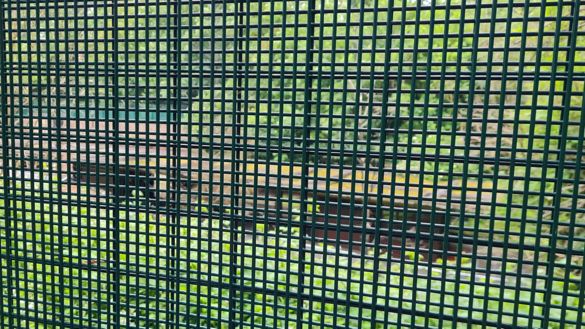
Traversing a fairly steep incline out of the cutting, I entered the suburb of Highgate. It felt like a pleasant area, with independent shops and gastro-pubs on both sides of its admittedly busy main road. Thankfully, Highgate is not simply a concrete jungle. Walking for just a few minutes can lead you to either of its two tranquil woodland parks. The last time I was here, I visited the Queen’s Wood, part of the ancient Great Forest of Middlesex. Though well worth a visit, this would have taken me in the opposite direction of the old railway line. Instead, I plumped for Highgate Wood, which the line would have snaked around. Before making a break from the traffic noise, I had one more place to visit here. I walked around the entrance of the London Underground station and down another steep slope. Behind a green metal fence was what I was looking for, the disused original Highgate station.
Highgate
Year Opened: 1867
Year Closed: 1962 (1954 to Passengers)
History of the Station
Highgate was one of the original stations on the line between Finsbury Park and Edgware, being opened in 1867. It was originally built with two side platforms and a central area for the trains. The original station building and its platform survives to this day as private dwellings. A few years later, in 1873, the branch line to Alexandra Palace was officially opened. This branch line deviated from the main line to Edgware after leaving the western tunnel, at what is now a London Underground depot. The section between Highgate and Edgware is still used to this day as part of the London Underground’s Northern line. In the 1880s, the station was remodelled as an island platform; its central building was later redeveloped in 1935.
The Station Today
A few years ago, you could take guided tours of the old Highgate station. Due to a combination of fire and the COVID-19 epidemic, this unfortunately ceased. As at the time of writing this, Highgate has been removed from Hidden London’s list of available tours. I am not sure this will ever resume. This is a real shame, as I am sure that Highgate has plenty of brilliant surviving features, being one of the original stations on the line. Today, the closest you can physically get is the Priory Gardens entrance to the Underground station.
Entering Highgate Wood, I realised that it was much larger than I had previously expected, so I spent a couple of minutes realigning myself on a bench. I was looking for the westernmost edge of the woods, which ran parallel with the line to Alexandra Palace. I found it soon enough, though separated from the line by a fence and thick bramble, I had resigned myself to simply having a pleasant walk in Highgate Wood. That was until I came across something unexpected. At the aptly named Bridge Gate, was a bridge over a slight ravine in the wood. The dual brick arches were proof that this was undoubtedly where the railway would have passed under. The ground was soft from recent rain and, coupled with the precarious way down (and up), I decided this was one slope too far and continued on.

Ensuring that the trees stayed rooted to my right, the soft dirt track became a concrete alleyway. This led me parallel to a school built on top of the line and a group of sidings. Reaching the road, I was greeted by a sign directing me to start the northern section of the Parkland Walk. Instead, I took a couple of left hand turns as I searched for remains of Cranley Gardens station.
Cranley Gardens
Year Opened: 1902
Year Closed: 1954
History of the Station
Much like Stroud Green, Cranley Gardens station was built after the line was opened to attract passengers from suburban communities. Pictures online reveal that the platforms were built on a curve as the line continued to snake around Highgate Wood. There was a street level booking office, on what is now the fairly busy B550, and sidings to one side. The station building was demolished with the station in the 1960s, leaving no remains.
The Station Today
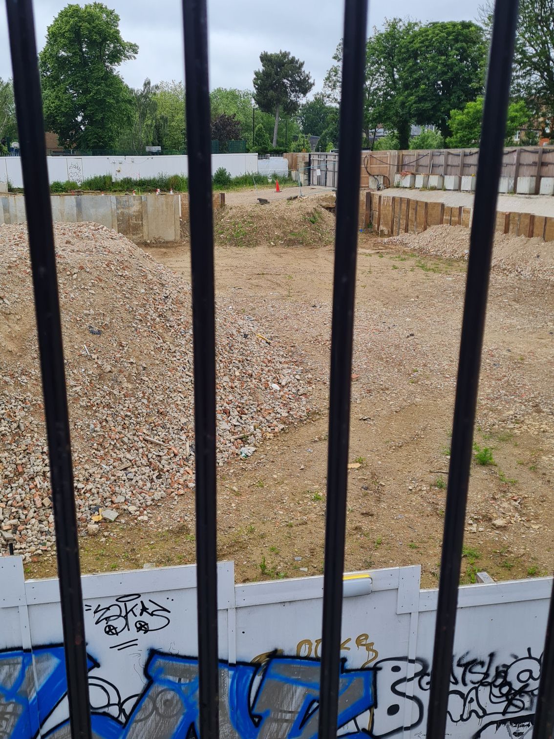
Before doing this walk, research had told me that nothing remains of the old station, with a care home being been built over the site. When visiting, I found a construction site and piles of rubble, with the care home demolished. Signage around the site suggested that this will be turned into housing by 2025. Whilst it was further confirmation that nothing remains of Cranley Gardens station, this development did provide a unique perspective. Looking over the edge of the road bridge, I could clearly see the station’s footprint and the line’s south-westerly path towards Highgate. Leaving Cranley Gardens behind me, I followed signs to the Parkland Walk and continued towards Alexandra Palace.
Part 3 – Parkland Walk North (Cranley Gardens – Alexandra Palace)
The Parkland Walk (North) does admittedly lack much of the architectural quirks of its southern counterpart, but there is still much to appreciate. Turning around immediately after joining the path, you can clearly see the developments made to the road bridge over the years. A layer of concrete sits below the brickwork, and part of the roof is made of concrete beams. As the road has increased in size and traffic, the bridge was updated to accommodate this. Looking at old photos of the station from the mid 20th century, this improvement work was evident then. The clouds were still moody and threatening rain as I started this section of the walk.
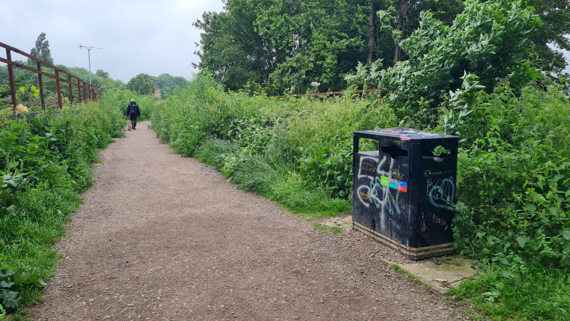
Again, the path took me through a tree-lined cutting between two rows of houses. I noted that this cutting was much deeper than back at Crouch End. On this section, I passed at least three people with their dogs, as well as a couple of families. This typifies what I have seen on the Parkland Walk, how much it was used by joggers, cyclists and walkers. If nothing else, it shows that old railway lines, with their lack of inclines and relative straightness, make great paths. From exploring a few closed railway lines, I believe it is better that these are given second lives. The alternative, which I have seen elsewhere, is for these to become derelict and be built on haphazardly. Maintained excellently by the Friends of the Parkland Walk, this is a perfect example of the potential a closed railway has.
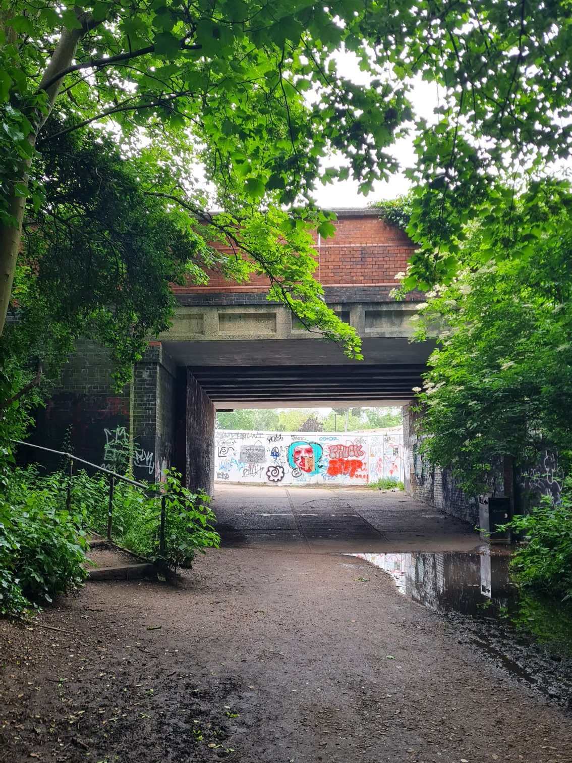
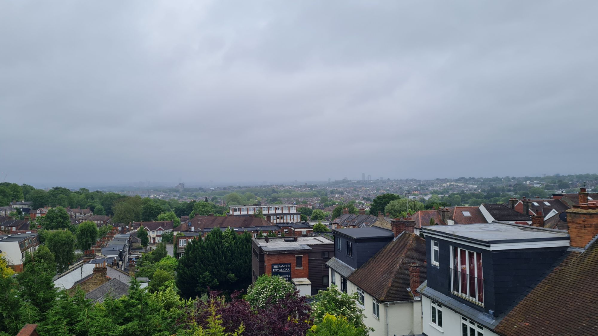
Ruminating on this as I walked, I reached my undoubted favourite part of this section of the Parkland Walk. On approach to the next station, the path crosses over St James’ Viaduct high above the road. On a good day, the panoramic views stretch out and incorporate landmarks in central London and beyond. The weather was not my friend on this day, but the view still made me pause and take everything in. This is also a section that I would highly recommend to people in the north London area. I can only imagine how passengers must have been captivated by the view in the line’s heyday. Unfortunately, this marked the end of the admittedly short northern section of the Parkland Walk. I was faced with a narrow subway, dingy looking in spite of its luminous radioactive green colour. Walking swiftly through this less than pleasant underpass, my next task was to find the remains of Muswell Hill station.
Muswell Hill
Year Opened: 1873
Year Closed: 1956 (1954 to Passengers)
History of the Station
Muswell Hill station was opened along with the branch between Highgate and Alexandra Palace in 1873. Pictures taken during the station’s use showed that it was very much like Cranley Gardens. The two platforms and tracks were on a curve, with a street-level building and canopies at one end. Trains would have passed under a bridge and not through the ugly green subway that replaced it. There were also some sidings to the south of the platform. Also like Cranley Gardens, nothing remains of this station, with a school being built on its site. A handily placed bridge leading to the park provided a partial view of where this old station once stood.

The final stretch of the line saw it run along a ridge on the northern edge of Alexandra Park. Today, this spot is occupied by a visitor centre and a tree nursery. A brief visit to the latter showed how the slight cutting on either side of the line remains. By this time, my legs were starting to tire, so I stopped at The Grove Cafe for another well-needed mocha. Alexandra Park looked lovely, especially the old-style lampposts but, with the light slowly starting to fade, I took a left turn back out of the park. I headed under the final bridge on this line and turned right into Dukes Avenue. This took me parallel to the line; at the road’s end, I turned right into The Avenue. With the imposing Alexandra Palace looming over me, in its shadow was the terminus of the line, Alexandra Palace station.

Alexandra Palace
Year Opened: 1873
Year Closed: 1954
History of the Station
The terminus of the branch to Edgware was built fully in mind with connectivity to the Palace. The station was positioned directly next to a wide stairway which led to the original entrance to the venue. This stairway survives to this day, locked from access behind a set of royal blue gates. The two tracks stood either side of an island platform, though a third shorter section of track once sat to its south. The track continued to the north-west corner of the palace to allow engines to run around its carriages. The station was closed on a couple of occasions when demand for the Palace decreased, notably after the 1873 fire. When the line was closed, the track was immediately raised, and the station fell into a state of disrepair. In the mid 1980s, it was taken over by a group called ‘Community Use For the Old Station’ or CUFOS. They, with financial assistance from the council, turned this into a community centre which still stands today.

The Station Today
As I approached this station, I was first struck by how seamlessly it emulated the architecture of the Palace. Its cream brick face with window arches of burnt orange gave this station an extravagance that its location deserved. Though small, the station building has a sense of majesty and occasion, with only some detailing lost since its closure. Pictures from the mid 20th century reveal that it previously had a canopy over its frontage and a large sign which read ‘British Railways, Alexandra Palace station’. Head to the corner of the Palace and look down the north service yard for a complete view of the old station’s footprint. It was a suitably majestic conclusion to a railway walk which delivered on its reputation as one of the best in the country.

Conclusion
There is little doubt that the fate of the line was sealed by the decision not to connect it to the London Underground. With hindsight, its electrification and connectivity would have allowed passengers to get to the Palace with less changes. Today, those stopping at the East Coast Main Line’s Alexandra Palace station have two choices: walk up the hill or get a shuttle bus. Plus, it would have allowed for seamless connection to the rest of the London Underground network. On the other hand, sections of the line simply added journey time with little benefit to communities. If one was to travel from Finsbury Park to Alexandra Palace, it would be quicker to travel on the ECML and change, than travel on this line. The section from Highgate to Alexandra Palace made more sense from a connectivity standpoint, though I have my doubts whether there is the necessary demand. Considering the history of the line, I do believe that its closure was warranted.

I have explored several abandoned railway lines in London, but this was my favourite to walk and explore. It has the enjoyment of the Woodside and South Croydon, but over a more accessible distance. I found that much of the line’s character had been preserved in the Parkland Walk, as I passed high above the streets of north London, and traversed wooded areas. The remains of Crouch End and Alexandra Palace, the tunnels around Highgate, and all the other architectural quirks. The romantic mystique of the railways, which I have experienced since I was young, was fully present on this walk. There is simply too much to say to write down, and I have said quite a lot already! The Friends of the Parkland Walk have done a great job maintaining this route whilst paying tribute to the railway. I would recommend the Parkland Walk to anyone who has a few hours free.

Thank you for taking the time to read my account of exploring the line between Finsbury Park and Alexandra Palace.
If you would like to learn more about the Friends of the Parkland Walk, you can find them at https://www.parkland-walk.org.uk/. If you would like to see how each station on the line looked when active, http://www.disused-stations.org.uk/ has some brilliant photographs and historical background.
If you enjoyed reading this, please do leave a like. I have since explored another couple of routes, one of which takes me out of London and well into Surrey. If you want to be notified when new posts are published, please do subscribe to this blog.
Have you ever walked the Parkland Walk and, if so, what do you like best about it?
Do you have any memories of the old line between Finsbury Park and Alexandra Palace, or abandoned lines more generally?
Do you have any recommendations of lines that are well worth exploring?
Please feel free to comment your thoughts below or send an email to editor@thebloggingdj.com.
Previous Posts
#1 – Crystal Palace (High Level) to Nunhead – London, UK
#2 – Woodside to Selsdon (feat. Addiscombe) – London, UK
#3 – Seven Sisters to Palace Gates – London, UK
#4 – Mill Hill East to Edgware – London, UK
