
Since I was young, I have been interested in the railways of the UK. Trips to railway museums fuelled my interest in eras long past, when steam trains chugged up and down the country, travelling to quaint villages and seaside towns. Many of these older lines and stations no longer exist today; their remains laying abandoned and forgotten, or built on by modern infrastructure.
In this series, I explore the abandoned railways of the UK on foot, investigating the remains that can be seen today, looking into their histories and ultimate fates, and assessing whether there would be any benefit for these to be reopened today.
On a dry Sunday in April, I explored the remains of a line that continued past the London Underground terminus at Mill Hill East and on to Edgware, part of the Edgware, Highgate and London Railway.
A Brief History of the Line
The line which ran between Mill Hill East and Edgware was built by the Edgware, Highgate and London Railway in the 1860s as part of their line between Finsbury Park and Edgware. This was a small railway company, and the line was sponsored and then purchased by the larger Great Northern Railway (GNR) even before opening as a single track line in 1867.
The line connected with the GNR at Finsbury Park at its southern end, with the route running along part of what can be walked today as the Parkland Walk. This section branched off to a separate line that ran right up to Alexandra Palace, whereas the ‘main’ line ran up through East Finchley and Mill Hill East, finally terminating at Edgware. Local residents will recognise many of these stations as part of the modern Northern Line on the London Underground, albeit sitting on different branches.

In 1935 the London Passenger Transport Board (known today as Transport for London) announced that they would take over the line between Finsbury Park and Edgware. As part of this, improvements would be made to the line, including total electrification and the doubling of track for the section between Mill Hill East and what is now known as Edgware Underground station. The original Edgware station would be closed as part of a wider project known as the ‘Northern Heights’, which would see the incorporation of the lines around Edgware and Finchley as the Northern line, and a plan to take the line further north to a station called Bushey Heath.

The Second World War halted all improvement work on the line, with the London Passenger Transport Board intending for these to resume after the war. The exception to this was the branch between Finchley Central and Mill Hill East, which was electrified due to the latter’s proximity to the nearby Inglis Barracks. However, after the war, the plan to take the Northern line further north was cancelled due to the potential breaking of Green Belt regulations. It was felt that the cost of upgrading Edgware would outweigh the monetary benefits in the long term. As a result, passenger traffic between Mill Hill East and Edgware, which had been halted for the war, never resumed. The line remained open to freight traffic for many years after, the old Edgware station becoming something of a goods yards, before eventually being withdrawn in 1964.
Exploring the Line
Part 1 – Finding the Path (Mill Hill East)
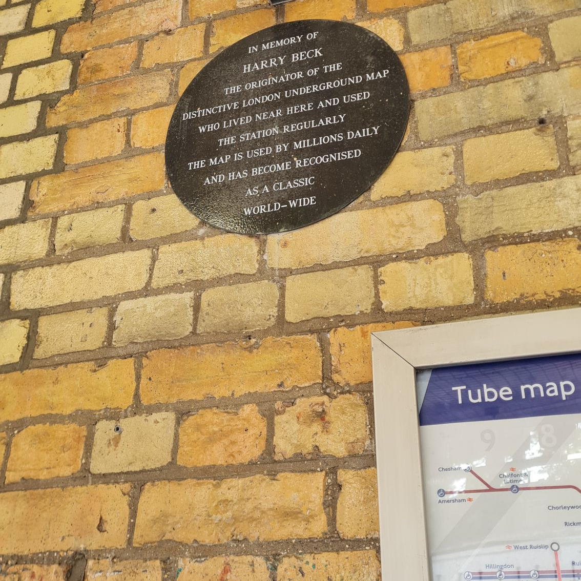
Arriving at Finchley Central tube station, a check of the skies and forecast brought hope that the weather looked like it would stay dry for the duration of the day. Mill Hill East is the least used station on the Northern line, which does not surprise me based on its poor off-peak service. Faced with a twenty minute wait until my train arrived, I looked around the charming station façade, and came across an information board and plaque tributing Henry Beck, better known as Harry Beck, the man who designed the London Underground map as we know it.
The Edgware, Highgate and London Railway faced several rapid changes in terrain on their route, which meant the railway had to make extensive use of cuttings and viaducts. I passed over one such example on the branch to Mill Hill East, the Dollis Brook Viaduct, the highest point on the London Underground above ground level, at nearly 60 feet (18m). Stepping off on to the raised platform at Mill Hill East tube station, I noted that it was decently busy for a station infamous as being the least used. I also counted several golf bags amongst my fellow disembarking passengers.

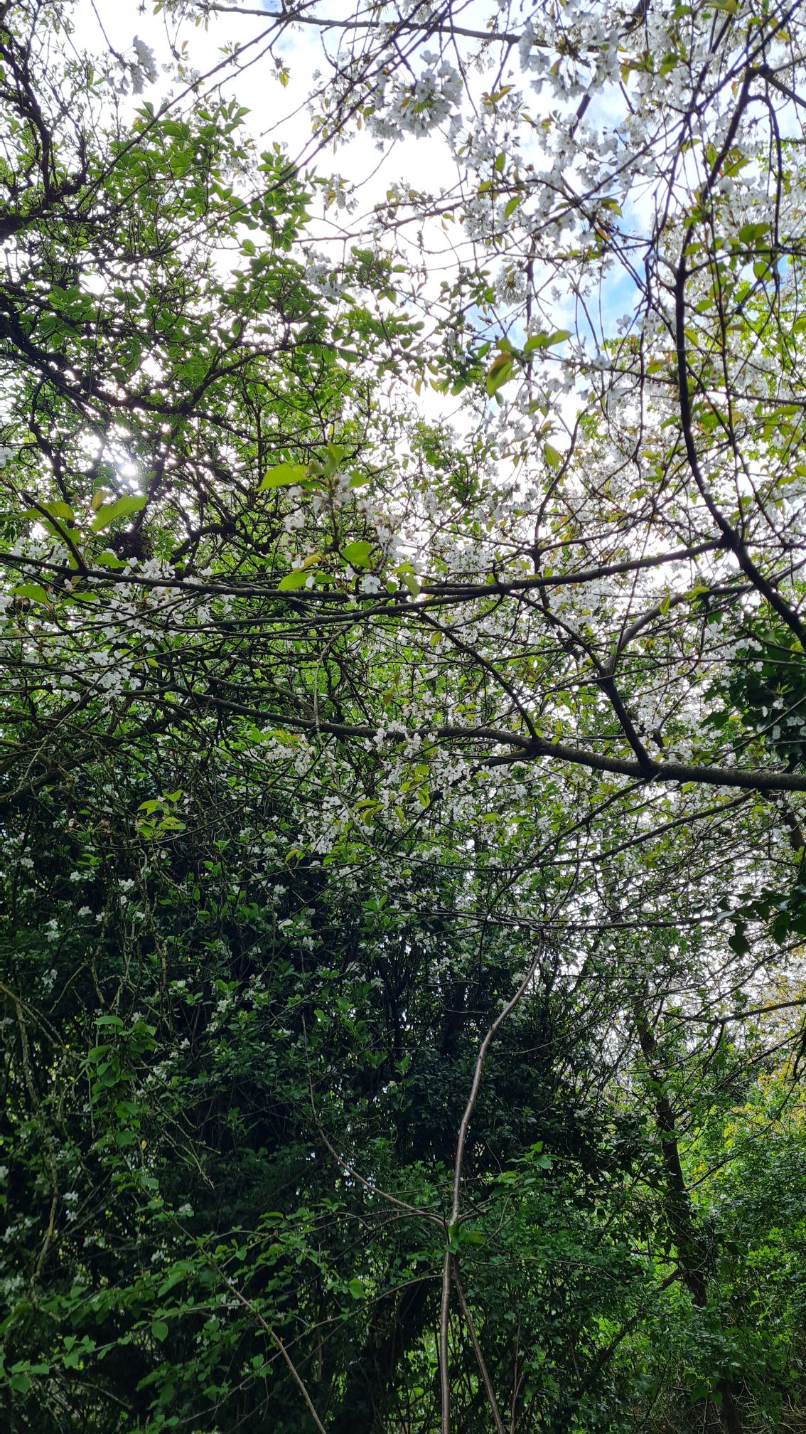
Unfortunately, I immediately faced my first major obstacle. The old line continued from the buffers at Mill Hill East, ran along an embankment and under the bridge carrying Sanders Way. However, Heras fencing and several laminated sheets of paper stuck to lampposts informed me that the entire bridge, including the path underneath and residential paths leading to it, would be closed for the foreseeable future due to maintenance works. I was forced to walk in the complete opposite direction to the old line, all the while praying that I could access the path at the second road bridge on the route. Passing Mill Hill East station for a second time, I noted its façade was very different from that of other London Underground stops and more akin to main line stations. I did walk along a pleasant road in Mill Hill, lined by trees that were blossom-filled, which made up for it somewhat.
Part 2 – Posts and Heights (Mill Hill East – Mill Hill (The Hale))
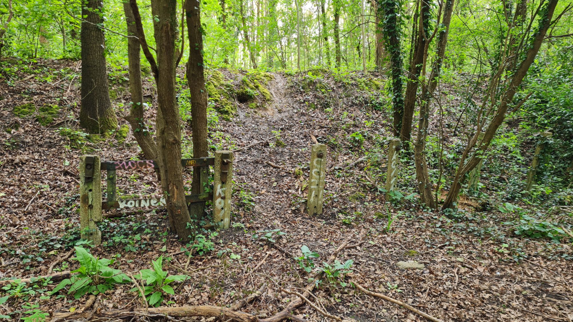
Thankfully, I was able to climb down the steps on Devonshire Road to the path of the old line. I immediately saw one remnant which survives today. The line was planned for electrification as part of improvement works, but this was halted by the war and was later cancelled. As a result, hundreds of little stone blocks, which were to carry the current for the electric London Underground trains, lined the path. More modern examples of these can be seen on existing tube lines today. Many of these concrete posts were overgrown by weeds and greenery, others had crumbled and had broken in half, whilst some stood straight, nearly 80 years after work on the line had ceased.

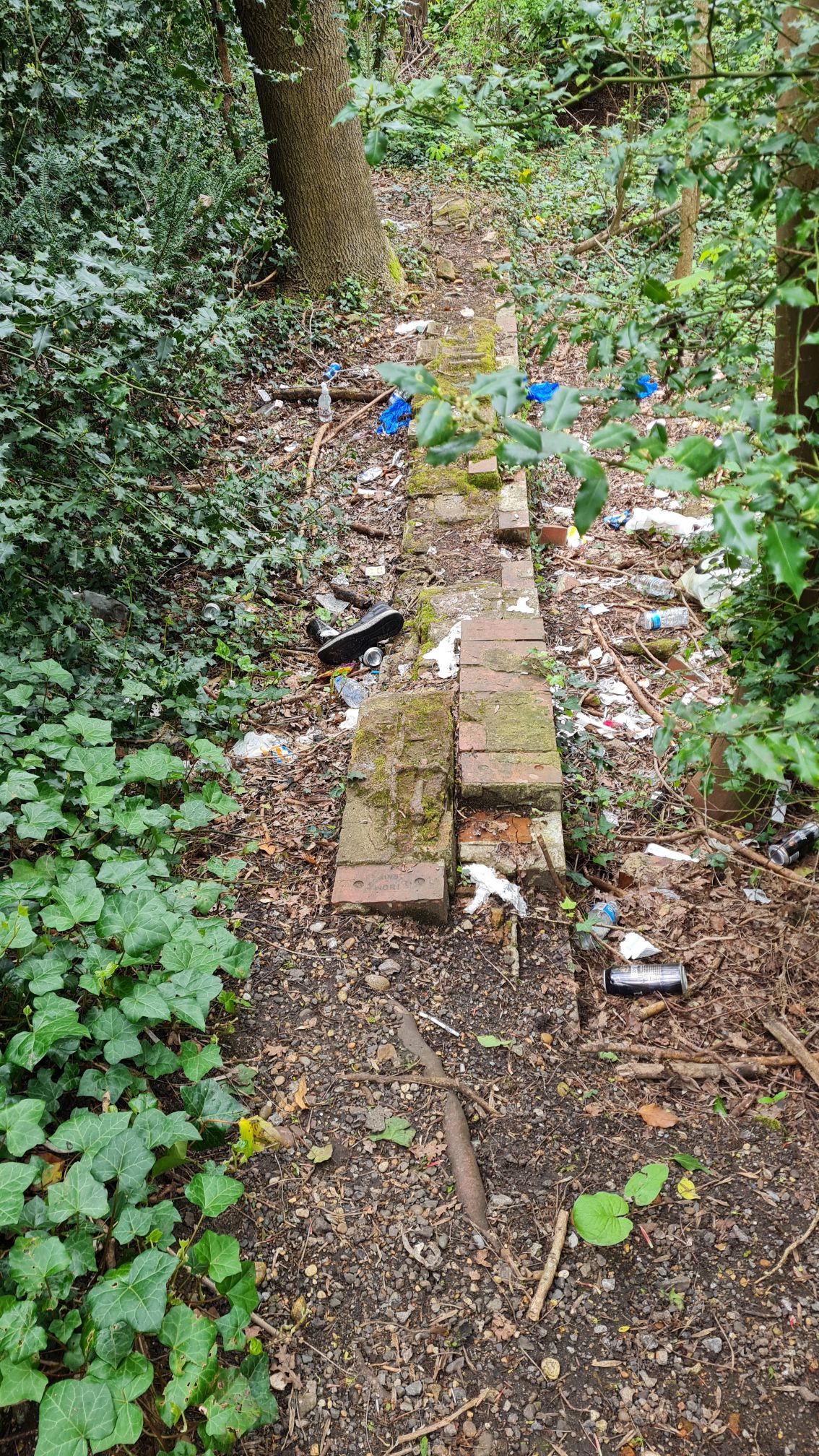
Had the line existed today, it would have run very close to where the Saracens play their matches. Thankfully, they were not playing a home match on that day, so my only company on the stretch of the path were a couple of dog walkers. I also passed Hendon Golf Course, which explained all of the golfers at Mill Hill East. Picking my way through some muddy sections from recent rainfall, I reached the end of the path and came across a bricked up pipe. This looked far too small for a train to chug through and, like other sections of the walk, was sadly covered in graffiti and full of litter. It was also the end of the pleasant wooded section; looking ahead, the line was buried under concrete and infrastructure, and required some effort to navigate.
Based on old pictures, the railway went into a cutting, infilled when the line closed. Had the line survived, there would have needed to be a lot of infrastructure, based on what faced me. I first had to take an underpass under the A1, which admittedly wasn’t too bad, but then I had to go over a narrow footbridge over the M1, and finally take another underpass under the Midland Main Line. The bridge over the M1 was the worst part of the walk by far, crossing a high bridge over cars whizzing by at 70MPH in slightly breezy conditions, which made me feel slightly dizzy! I was thankful to make it to the other end. After a short walk north towards Mill Hill Broadway, I found myself at the site of the only intermediate stop on the line, Mill Hill (The Hale).

The halt was built fairly late in the lifespan of the line, in 1906, in an attempt to bring more revenue to the line. Based on research, it wasn’t heavily used and was initially just a wooden platform on one side of the single track, before a second track and concrete platforms were installed during the Second World War. As passenger services stopped during this period and never resumed, the cost of the building work was for nothing. Today the site of Mill Hill (the Hale) is adjacent to a fairly pleasant park and is in a poor state, full of rubbish and not great smelling. The bridge portal which part of the platform would have run under was infilled with ugly concrete. A small length of brickwork remains, most likely the remnants of the old platform. There was also the tell-tale sign of a row of electricity posts. If this remained open, I’d expect this to be a direct interchange with the Midland Main Line station at Mill Hill Broadway, which is maybe a 2 minute walk away.
Part 3: The End of the Line (or Not?) (Mill Hill (The Hale) – Edgware)
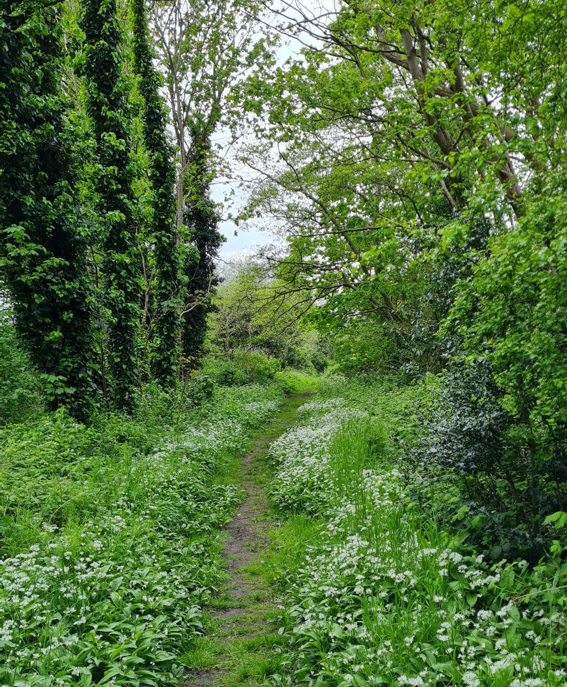
After the stress of crossing the A1 and M1, and the unpleasantness of walking amongst litter, I was rewarded with the best part of the walk, a Grade II-listed nature reserve known as the Mill Hill Old Railway Nature Reserve. This follows the path of the old line and takes about 20 minutes to walk through. I found myself at peace here. Birdsong surrounded me high up in the trees and huge quantities of wild flowers glowed in the sunlight. I was very fortunate to experience this, as the reserve is only open from 10AM to 4PM on Saturdays and Sundays. In the midst of the flora, I also glimpsed more of those electricity posts.

The best section of the route was unfortunately followed by a dull and meandering concrete maze. The line would have crossed under a road and headed straight into Edgware, but its path was infilled by the road to the depot for the Northern Line. Of course, there was no public access. Much like the start of the walk, I headed away from the path of the line in a roundabout route, crossing a road bridge that led over the Underground.
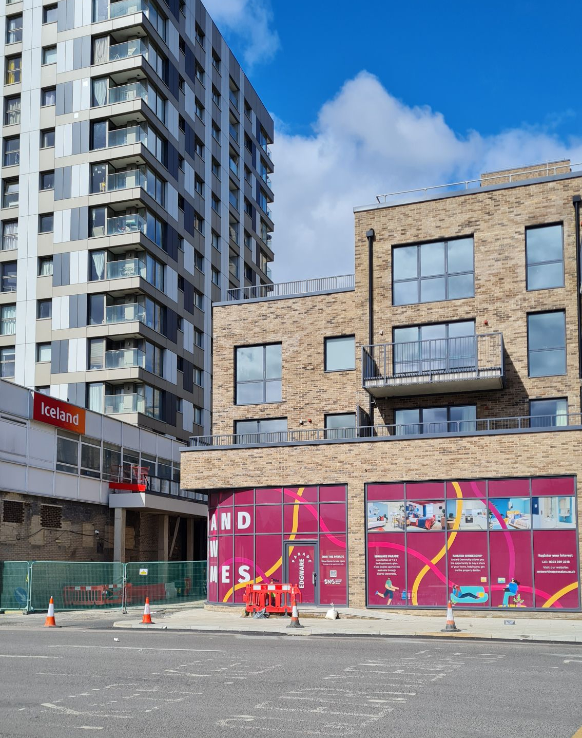
There was no reward for getting through this, as sadly no trace of the Great Northern Railway’s Edgware terminus remains. Its footprint, including the sidings, has been filled in and replaced with a car park for a large Sainsbury’s, whilst the imposing Premier House looms above. Looking at old pictures, this glass and metal block of flats were built around the same time the station closed to freight traffic. The only hint of the old station is the clinic adjacent to the car park, which was listed as being on ‘Station Road’.
As I walked into Edgware tube station, positioned literally next door to the site of the old station, I resigned myself to heading home without seeing anything more. Then I noticed a small section of tunnel directly behind the buffers. Had it been dug further, this would have been the start of a Northern Line extension, as part of the ‘Northern Heights’ project. This would have also seen the Mill Hill – Edgware section merge into the tube station, and the old station closed. This was abandoned due to costs and a lack of planning permission, but remains an anomaly and a reminder of what may have been, to this day.
Conclusion
When I consider the purpose of this line and how it would have integrated into the wider London Underground network today, its fate was heavily tied into that of the abandoned ‘Northern Heights’ project. Looking at the sites of the three cancelled stations along the extended route, Brockley Hill, Elstree South and Bushey Heath, they are all located on the edge of the settlements they are named after and, whilst there would have been housing development in these areas if the line was built, there is no guarantee that this line would have been a success.
Moreover, aside from Mill Hill East having an irregular shuttle service and some through trains in peak hours, the connectivity of the Northern line meant that the Mill Hill East – Edgware line would have served sections already receiving services. There could have been a useful connection between Mill Hill (The Hale) and Mill Hill Broadway, but that is the only benefit I can see.

The walk along this line was enjoyable in some parts and frustrating in others. The highlights were undoubtedly the more rural sections, and I would definitely recommend a visit to the Mill Hill Old Railway Nature Reserve. The remnants of the line being reclaimed by nature, whether that is the brickwork at Mill Hill (The Hale) halt, or the electricity concrete posts, were also highlights, and gave me the same feelings as I had when exploring Spencer Road Halt on the Woodside and South Croydon Joint Railway, or the tunnel portals along the Crystal Palace (High Level) branch. Whilst this stretch of The Edgware, Highgate and London Railway has not seen passenger rail services in more than 80 years, its legacy lives on through its accessible walking routes.
Thank you for taking the time to read this piece on exploring the route between Mill Hill East and Edgware. Please do leave a like if you enjoyed reading this. At the time of publishing, I have since explored the route of another abandoned railway in London, maybe the most well-known of them all. If you want to be notified when this post and other new posts are published, please do subscribe to this blog.
Have you ever explored this line, or do you have memories of the old Edgware station?
Do you have any recommendations of abandoned railway lines and transport hubs in London and beyond which are well worth exploring?
Please feel free to comment your thoughts below or send an email to editor@thebloggingdj.com – I read all comments left on my posts and try to reply to as many as I can.
Stay tuned for #5 in this series of Walking Abandoned Railways – The Parkland Walk.
